
3-D Map Made of Lincoln’s Presidential Cottage

Tuesday, August 25, 2015
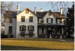 CORTLAND, NEW YORK—Scott Stull of the State University of New York, Cortland, and Michael “Bodhi” Rogers of Ithaca College have used lasers to create a 3-D map of President Lincoln’s Cottage, located on the grounds of the Armed Forces Retirement Home in Washington, D.C. The cottage, a 34-room Gothic revival mansion, served as Lincoln’s summer retreat from 1861 until his assassination in 1865, and was where he finished writing the Emancipation Proclamation. “This was a very important place for Lincoln because you could get away from the press of the crowd. And the design of the house was very well situated to get the summer breezes. The whole south side of the house opens up for some accentuated cross breezes from off this long hill,” Stull said in a press release. The house was also used by Presidents James Buchanan, Rutherford B. Hayes, and Chester A. Arthur. The team will next assist with the mapping of President Ulysses S. Grant’s retreat near Saratoga Springs, New York. “Looking at two presidential cottages is like looking at a very specific aspect of society, but they are one of the manifestations of how the political elite lived,” Stull explained. To read more about laser mapping, go to "The Past in High-Def."
Advertisement
IN THE CURRENT ISSUE
Digs & Discoveries
Ancient Egyptian Caregivers
Educational Idols
Cleaning Out the Basement
Pompeian Politics
Near Eastern Lip Kit
Turn of the Millennium Falcon
Speaking in Golden Tongues
Workhouse Woes
Hunting Heads
The Amazon’s Urban Roots
Off the Grid
Around the World
Panama’s golden grave, Viking dental exams, an unusual papyrus preservative, playing games in ancient Kenya, and a venerable Venetian church
Artifact
Within a knight’s grasp
Advertisement

Recent Issues
-
May/June 2024
-
 March/April 2024
-
 January/February 2024
-
 November/December 2023
-
 September/October 2023
-
 July/August 2023
-
 May/June 2023
-
 March/April 2023
-
 January/February 2023
-
 November/December 2022
-
 September/October 2022
-
 July/August 2022
-
 May/June 2022
-
 March/April 2022
-
 January/February 2022
-
 November/December 2021
-
 September/October 2021
-
 July/August 2021
-
 May/June 2021
-
 March/April 2021
-
 January/February 2021
-
 November/December 2020
-
 September/October 2020
-
 July/August 2020
-
 May/June 2020
-
 March/April 2020
-
 January/February 2020
-
 November/December 2019
-
 September/October 2019
-
 July/August 2019
-
 May/June 2019
-
 March/April 2019
-
 January/February 2019
-
 November/December 2018
-
 September/October 2018
-
 July/August 2018
-
 May/June 2018
-
 March/April 2018
-
 January/February 2018
-
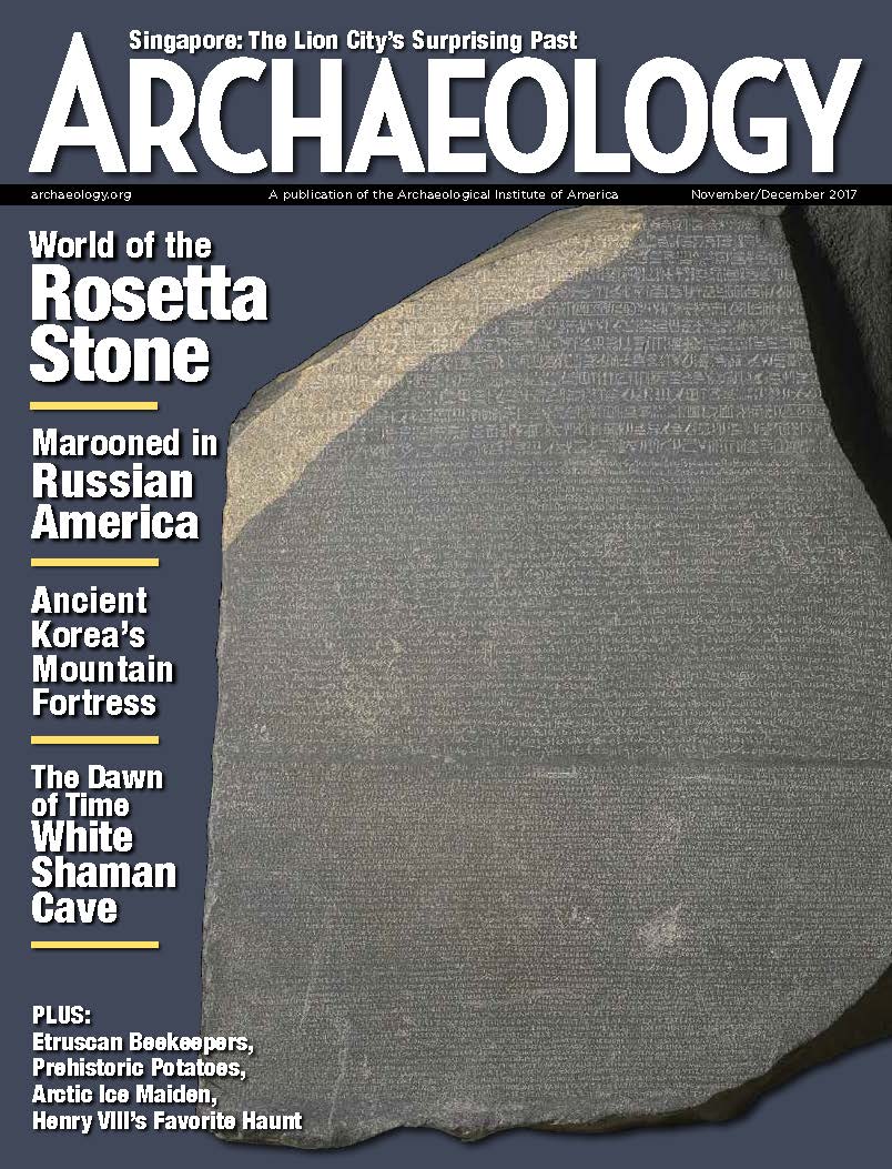 November/December 2017
-
 September/October 2017
-
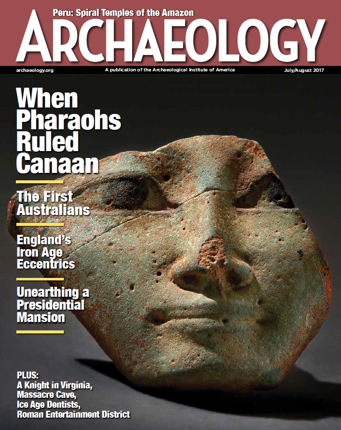 July/August 2017
-
 May/June 2017
-
 March/April 2017
-
 January/February 2017
-
 November/December 2016
-
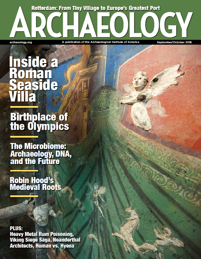 September/October 2016
-
 July/August 2016
-
 May/June 2016
-
 March/April 2016
-
 January/February 2016
-
 November/December 2015
-
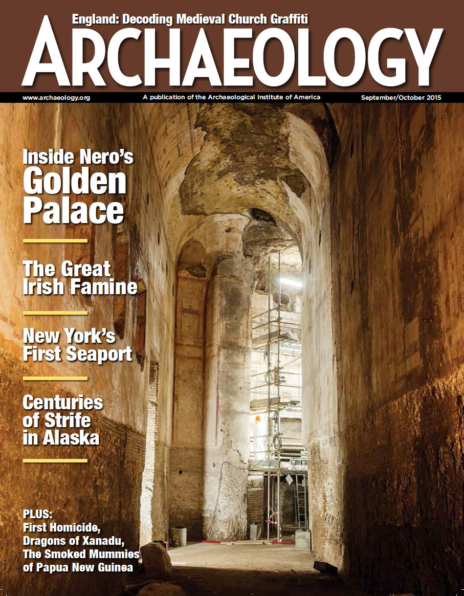 September/October 2015
-
 July/August 2015
-
 May/June 2015
-
 March/April 2015
-
 January/February 2015
-
 November/December 2014
-
 September/October 2014
-
 July/August 2014
-
 May/June 2014
-
 March/April 2014
-
 January/February 2014
-
 November/December 2013
-
 September/October 2013
-
 July/August 2013
-
 May/June 2013
-
 March/April 2013
-
 January/February 2013
-
 November/December 2012
-
 September/October 2012
-
 July/August 2012
-
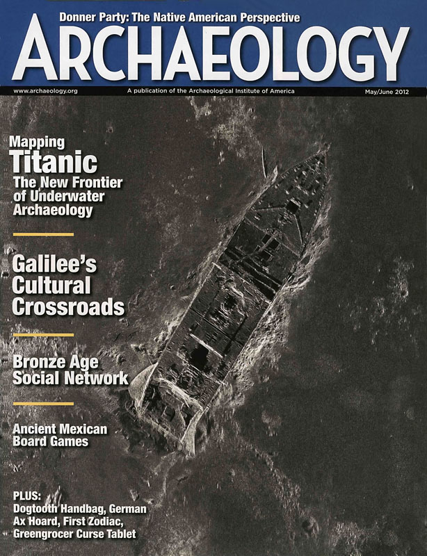 May/June 2012
-
 March/April 2012
-
 January/February 2012
-
 November/December 2011
-
 September/October 2011
-
 July/August 2011
-
 May/June 2011
-
 March/April 2011
-
 January/February 2011
Advertisement