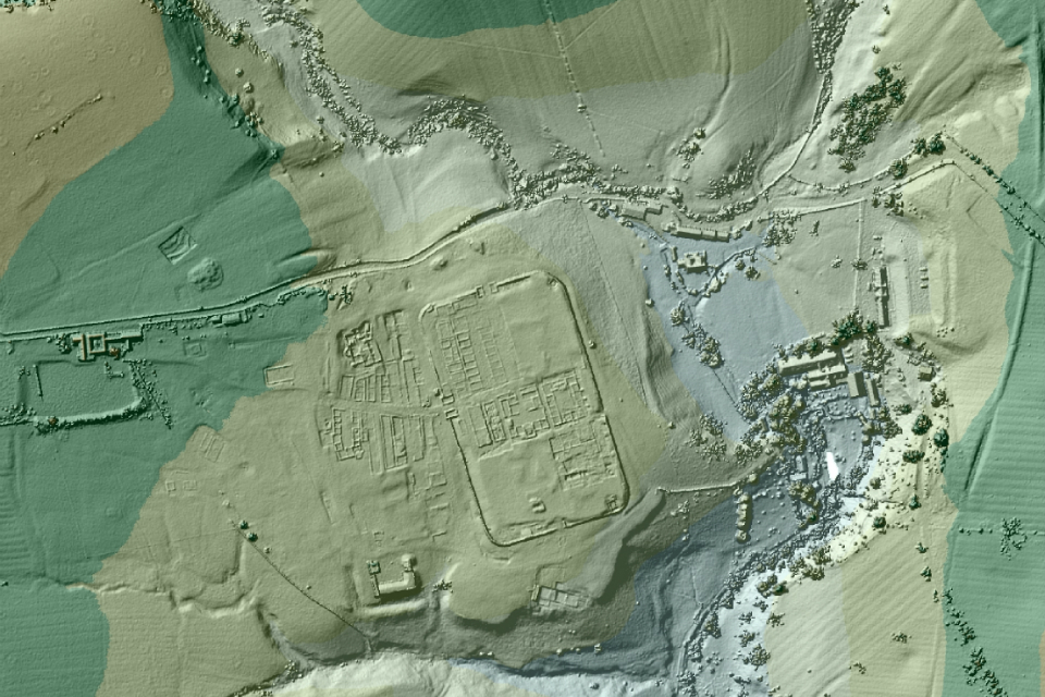
LONDON, ENGLAND—Archaeologists have used Lidar images produced by Britain’s Environment Agency for flood modeling and monitoring coastlines to look for roads that the Romans built in the first century during the conquest of northern England. David Ratledge has been looking for Roman roads in Lancashire for the past 45 years. Using Lidar data, he’s found a road that stretches from Ribchester to Lancaster, a distance of more than ten miles. “Previously in Lancashire we only had aerial photographs from the 1940s and 1960s to go on, but with photographs features only show up after a drought and we don’t get many of those! With Lidar, once you know what to look for, it’s blindingly obvious—you just know you’ve found a road,” he said in a press release. Four more Roman roads have been found by Hugh Toller and Bryn Gethin, including a missing part of the “Maiden Way” in Cumbria that connects the fort at Low Borrowbridge to a cavalry camp at Kirkby Thore, before it continues on to Whitely Castle and Carvoran Roman Fort, near Hadrian’s Wall in Northumbria. “These were the county’s most important Roman sites so good communications between them must have been essential,” said Ratledge. To read more about LiDAR, go to "Lasers in the Jungle."