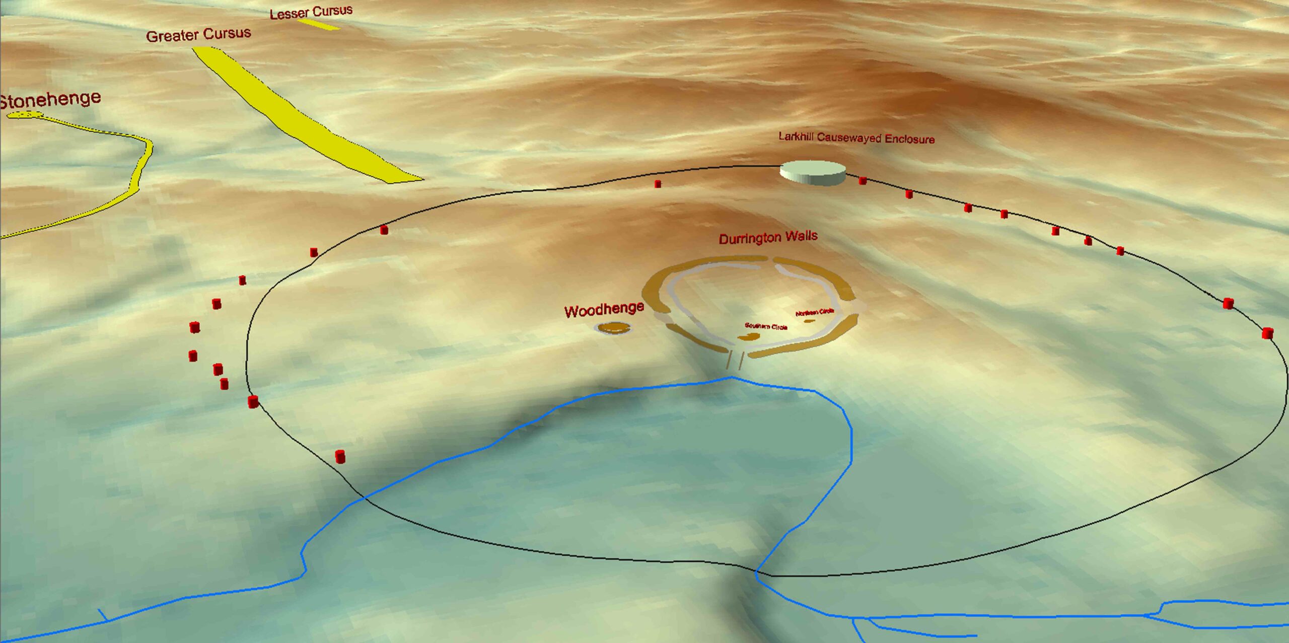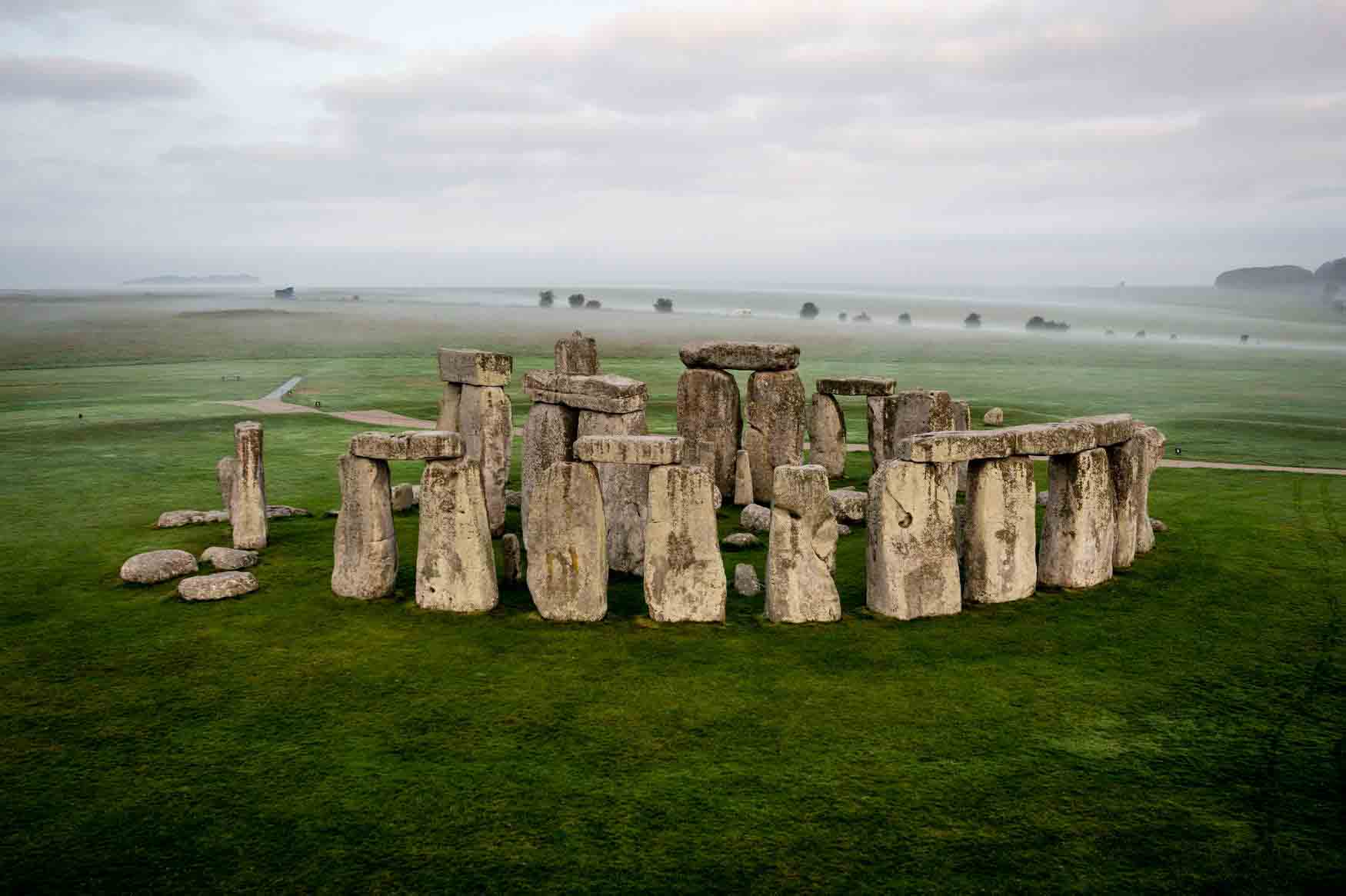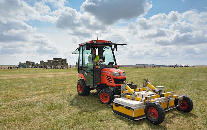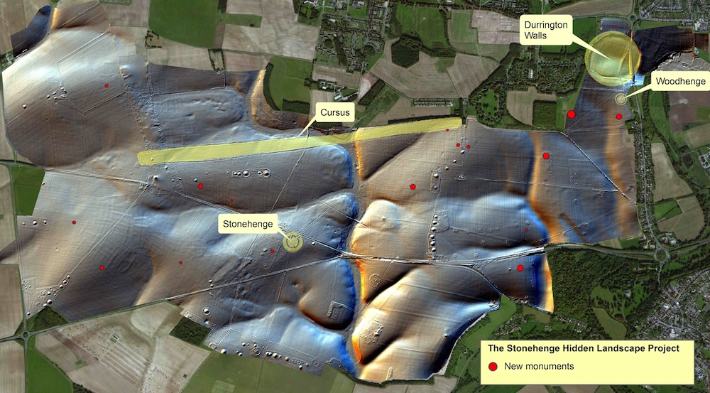
WILTSHIRE, ENGLAND—Information gathered with high-tech equipment during a four-year project to survey the area around Stonehenge has been converted into a new digital map. Among the discoveries are two massive pits that are older than Stonehenge and appear to form astronomical alignments on midsummer’s day. Stonehenge was eventually built upon the intersection point of the eastern pit’s alignment with the rising sun and the western pit’s alignment at sunset. Also predating Stonehenge was a burial mound containing a massive wooden building. Wolfgang Neuber of the Ludwig Boltzmann Institute thinks it was used in burial rituals until it was later covered in chalk. Another huge henge known as Durrington Walls was found to the northeast. Its 70 massive stones or posts had been pushed over or laid flat. “This radically changes our view of Stonehenge. In the past we had this idea that Stonehenge was standing in splendid isolation, but it wasn’t… it’s absolutely huge,” Vince Gaffney, head of the Stonehenge Hidden Landscapes Project at Birmingham University, told The Guardian.