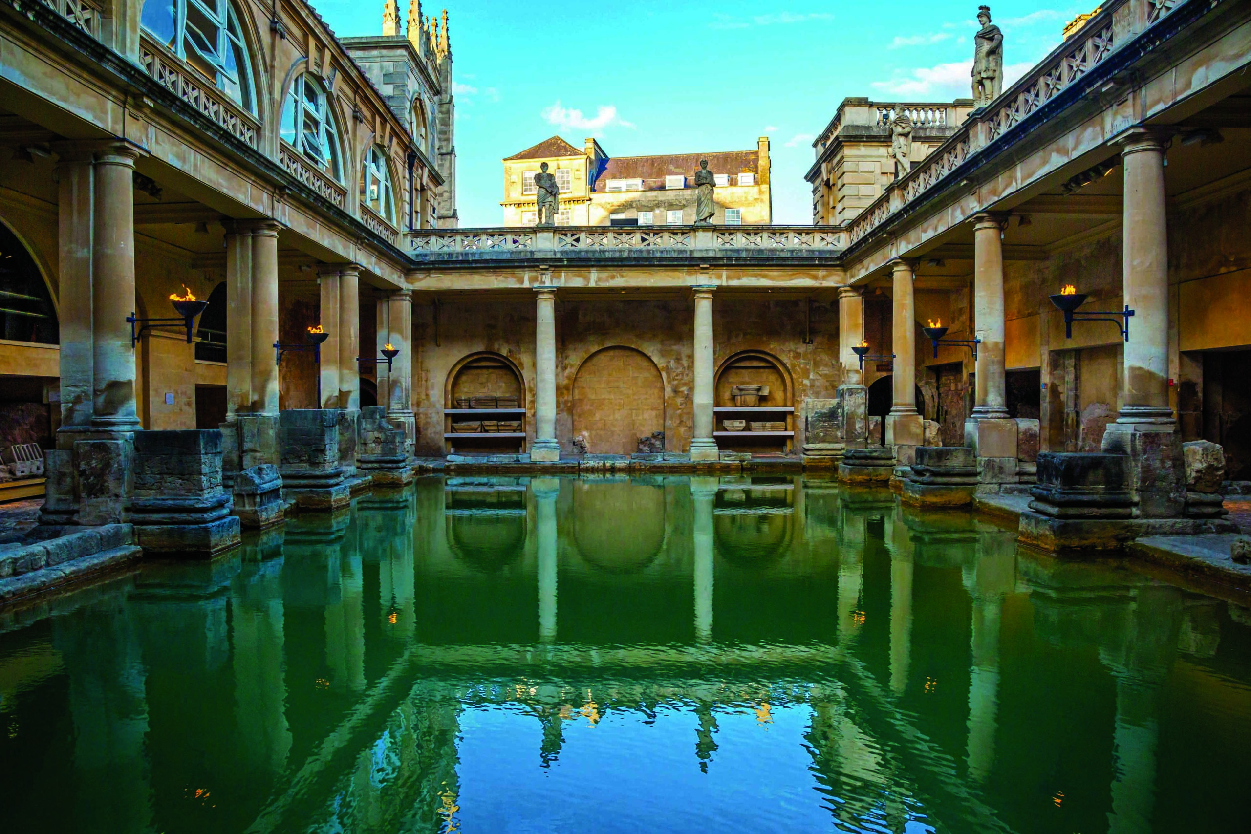
Creeping silently, the warriors emerged from the cover of the trees and made their way toward the fort. Minutes later the fort’s guards were surrounded by semi-naked men, their faces concealed by bushy beards, their bodies covered in tattoos. Some guards were dragged from their posts while others were dispatched with long spears. The warriors then surged over the wall and plundered and laid waste to the town beyond, leaving a trail of death and destruction. Once again, the Picts’ guerrilla tactics had caught their enemies by surprise. At least this is what the Romans, who occupied much of Britain from A.D. 43 to 409, would have the world believe. Given the name Picti—meaning “painted ones” in Latin—these people inhabiting northern Britain stood up to the Roman legions and, against all odds, prevented them from seizing their land.
The Picts emerged some 1,700 years ago in what is now northeastern Scotland—known in some sources as Pictavia, or Pictland—and left virtually no written records of their own and very few traces on the landscape they once inhabited. The handful of Pictish dwellings that have been discovered suggest they were a thinly spread population of farmers living in simple turf-walled houses, not the ferocious barbarians the Romans portrayed.
Believed to have descended from Iron Age Celtic tribes, the Picts were culturally and linguistically distinct from their neighbors, the Gaels, who inhabited what is now western Scotland, and the Britons, in what is now southern Scotland. The formation of their identity as a distinct group was likely accelerated by the presence of the Romans. This may have forced fragmented tribal groups to organize and cooperate with each other, forming several Pictish communities that became kingdoms in the face of a common threat. By the tenth century A.D., the Picts had seemingly vanished, leaving behind only myths and standing stones inscribed with distinctive symbols. “It’s one of the enduring mysteries,” says University of Aberdeen archaeologist Gordon Noble. “Who were these fascinating people?”
Over the last 10 years, Noble, who heads the Northern Picts Project, has excavated Pictish settlements in some of the most extreme and unlikely locations in northeast Scotland. Through excavations on windswept hilltops and crumbling coastal promontories, it is becoming clear that these sites were home to a well-connected, creative, organized, and highly skilled group of people whose true story is only now being thoroughly explored. Some of the legends surrounding them, it seems, may not have been so far-fetched after all.
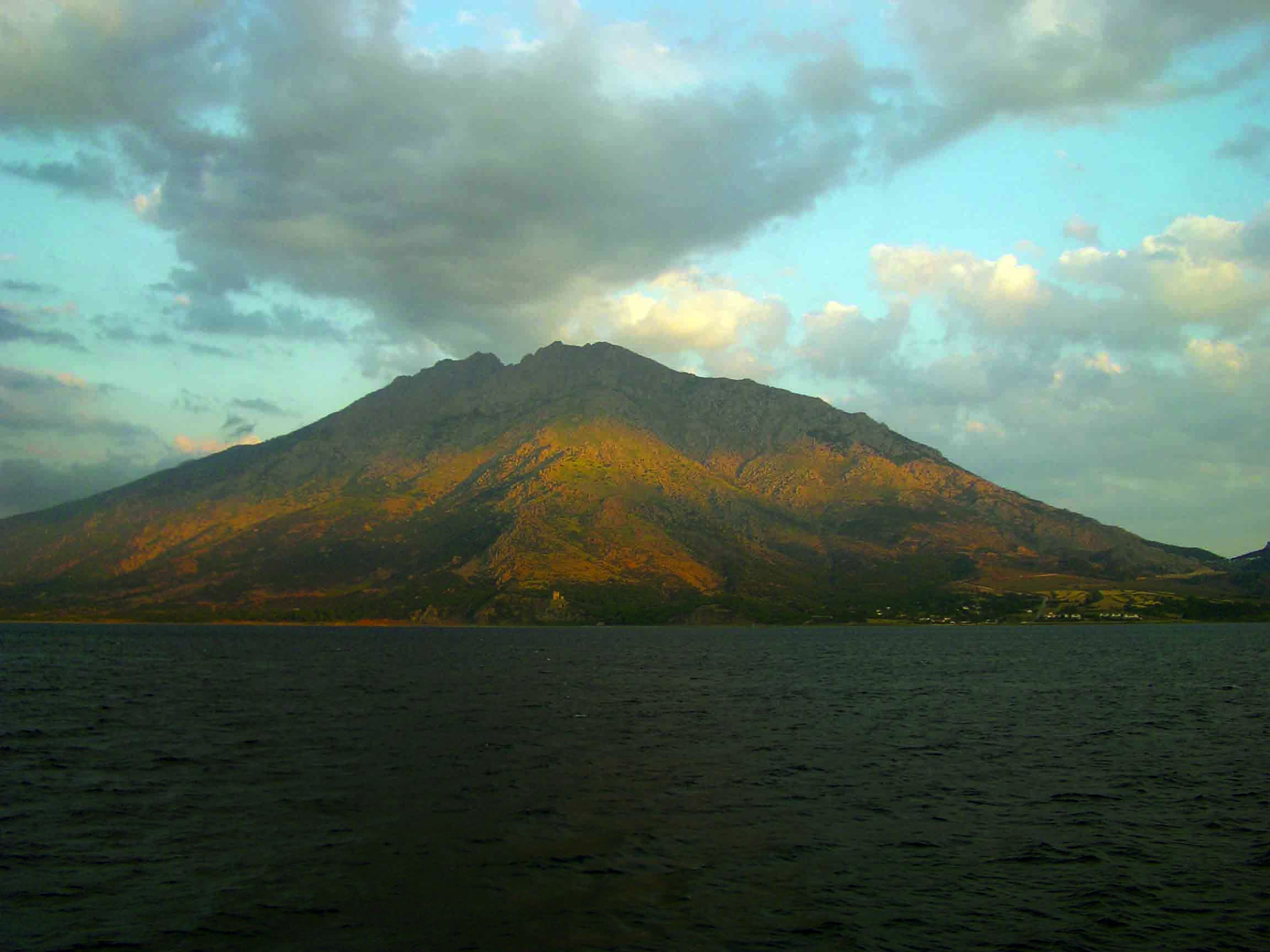
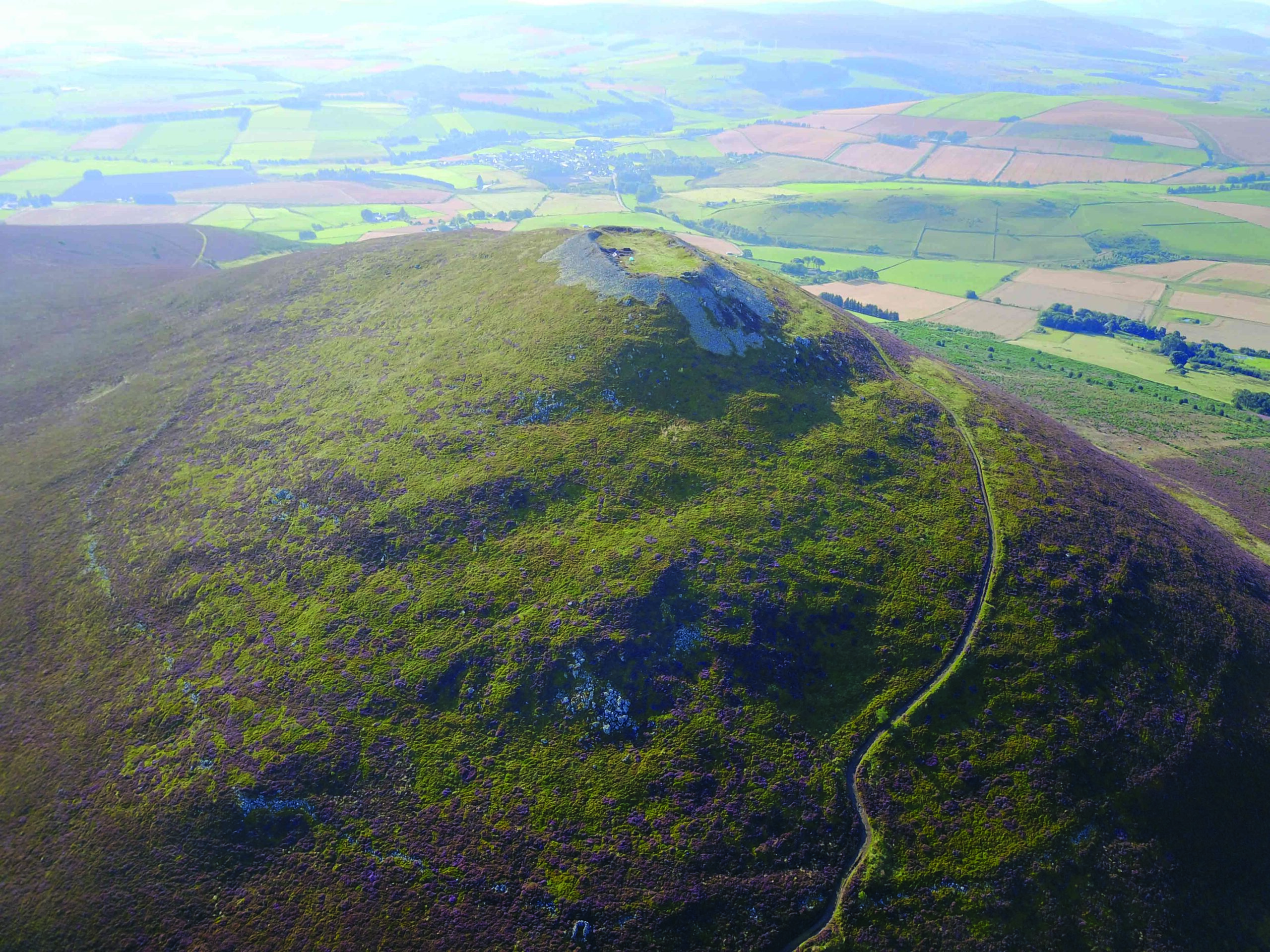
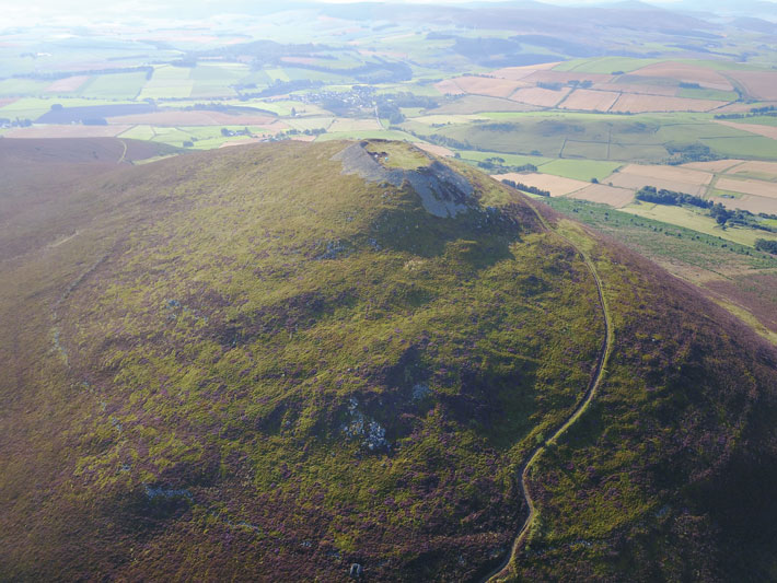
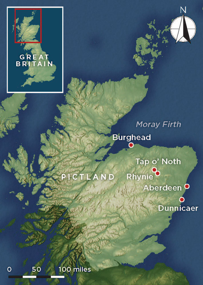
Forty miles inland from the modern city of Aberdeen, a hill known as Tap o’ Noth commands stupendous views. The snow-capped Cairngorm Mountains are resplendent to the south, and the glimmering waters of the Moray Firth are just visible to the north. Heather moorland, pockets of woodland, and rich rolling fields stretch away into the distance. Birdsong fills the air and the small village of Rhynie nestles in a sheltered pocket of farmland below. However, still air and blue skies are not the norm on this hilltop, and it would have been an even harsher environment from about the third to ninth century A.D. when the Picts lived in this part of Scotland. “There would have been snow up here in winter,” says Noble. “It’s a crazy place to live.”
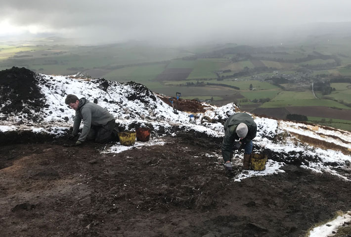
The remains of an earthwork equivalent in size to an Olympic swimming pool sit inside a 40-acre walled enclosure atop Tap o’ Noth. The enclosure had generally been assumed to have been inhabited during the Bronze (ca. 2500–800 B.C.) and early Iron Ages (800–400 B.C.), when Scotland enjoyed warmer temperatures that would have made living there an easier proposition. It was only as an afterthought, having discovered Pictish material in the valley below, that Noble and his team climbed Tap o’ Noth in 2019 to excavate the large enclosure and take a few samples for radiocarbon dating.
The charcoal samples, which Noble and his team extracted from a house platform and from the enclosure wall on the south side of the hill revealed that Tap o’ Noth had also been occupied from the third to sixth century A.D. “I have never been so surprised by a series of radiocarbon dates,” says Noble. A lidar survey pinpointed the remnants of more than 800 house platforms, dug into the hillside and clustered closely together. If each of the huts the team identified had four or five people living in it, then it’s possible that up to 4,000 people once lived on the hill. “It was absolutely mind-blowing,” says Noble. “We just had no concept whatsoever that sites of that scale would date to the Pictish period.”
Textual evidence of the Picts during this period is sparse. The only surviving text written by Picts themselves is a ninth-century list of kings, and while Roman, Gaelic, Brittonic, and Anglo-Saxon sources all mention the Picts, their tales tend to be based on hearsay and written long after the events they describe. This lack of firsthand information has reinforced the impression that the Picts were a backward people with few connections to the outside world. “These new finds are groundbreaking in terms of shifting our perception of what was happening in the late Roman and early medieval period,” says Nicholas Evans, a historian at the University of Aberdeen. “The Picts were clearly connected, and to have that many people living up there indicates they were well organized. I’m still struggling to get my head around it.”
The house platform the team excavated was covered by occupation layers comprising two feet of deposits and multiple floor levels. “In order to build up that kind of deposit, you are talking a long-term occupation—probably a couple of centuries,” says Noble. His team found sherds of Roman pottery dating to the third century A.D., along with evidence of metalworking in the form of clay molds and the remnants of crucibles. Clearly these people interacted with the Romans, whose frontier was more than 60 miles away at that time and who were skilled craftspeople themselves.
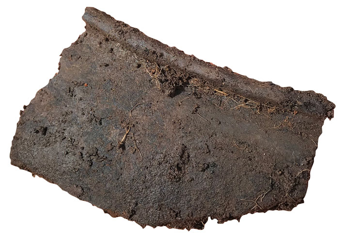
In April 2021, Noble and three colleagues returned to Tap o’ Noth to excavate a second house platform near the top of the hill. Unlike the first house platform they excavated, this one had only one floor level, suggesting a single short phase of occupation. It was a round or oval structure and had postholes for roof supports clustered around a central hearth. At floor level the team uncovered a few metal objects, including part of a copper-alloy pin that might have been a fastening for a cloak and some locally made pottery. Very little Pictish pottery has previously been found, and scholars have generally assumed that the Picts did not make their own pottery. “These pieces were really intriguing because they were made by hand, but made to look like wheel-thrown pottery,” says Noble. “This suggests that the Picts were being influenced by other cultures and copying exotic styles.”
Perhaps the most exciting artifacts to emerge were two small sherds of Late Roman amphoras, large storage vessels imported from the eastern Mediterranean in the late fifth or early sixth century A.D., well after the Romans had withdrawn from Britain. “It’s exceptional to find this anywhere in Pictland, never mind at a site nearly 1,800 feet high on top of an exposed hill,” says Noble. “High-status objects like this tell us that these weren’t just shacks up here, but belonged to important people. Perhaps they were drinking wine, or maybe they were cooking with Mediterranean oil.” These Roman amphoras not only suggest that the people living on Tap o’ Noth enjoyed an exalted status, they also hint at a far more extensive, and hitherto invisible, Pictish population. “If they were living up here year-round, then they must have been supported by a far wider population,” says Noble. “To live in this extreme location was an expression of power and dominance.”
There may have been thousands of people living in the valley serving the needs of the elites on the hill, but archaeologists will probably not find many traces of the valley dwellers today because their buildings had little in the way of foundations. “One traverse with a modern plow and any evidence of dwellings like these would completely disappear,” explains Noble. “This probably means we’re not going to find many Pictish settlements down in the lowlands.” However, Noble and his team have unearthed one substantial lowland settlement, near the village of Rhynie, whose neat patchwork of houses is visible from the top of Tap o’ Noth. Rhynie—a name derived from the early Celtic word rīg, meaning “king”—has long been suspected to have been an important Pictish settlement. “In Scottish place-names we have several different layers of language,” says Simon Taylor, a University of Glasgow linguist who studies Celtic languages. “This helps us to work out when a name was coined and by whom. It also helps us understand old settlement patterns. Names that survive over a long time, like Rhynie, tend to indicate places that were important.”
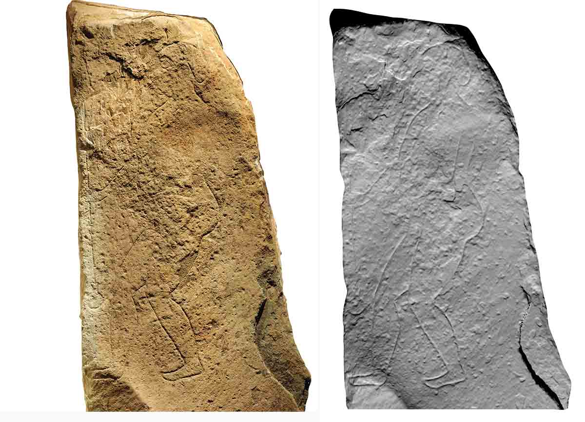
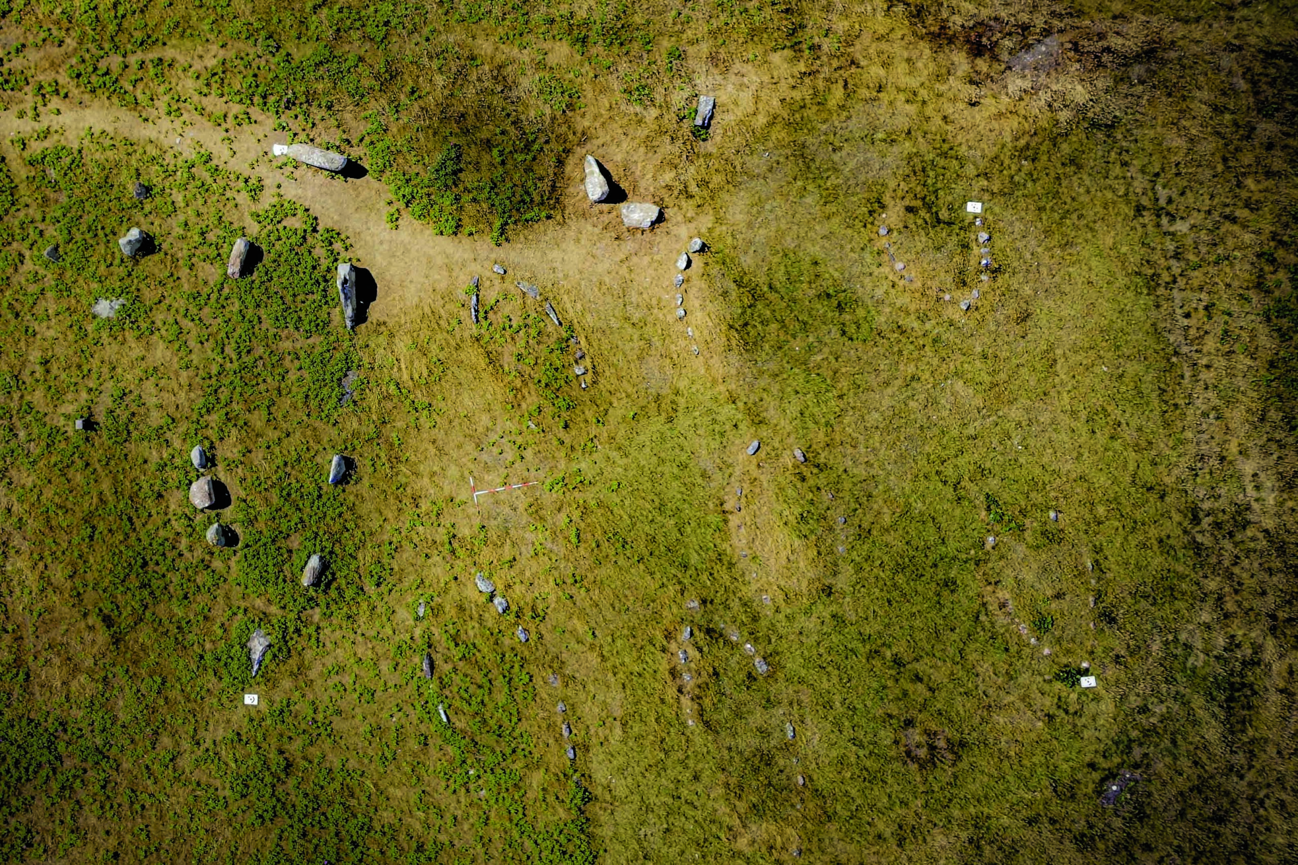
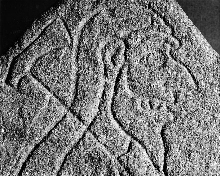
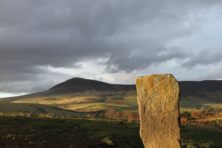
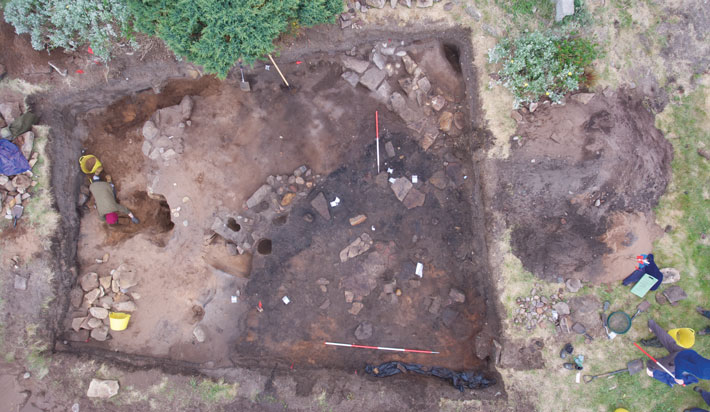
In 1978, a local farmer plowed up a spectacular carved Pictish stone just south of the village. Known as Rhynie Man, it depicts a bearded figure with pointed teeth carrying a distinctive ax. “We think that this ax might have been a symbolic version of a hammer that was used to kill cows and oxen, possibly as part of a ritual,” says Evans. In the same field, another Pictish stone, known as the Craw Stane, stands in situ. Between 2011 and 2017, Noble and his colleagues carried out excavations in the field and found that the Craw Stane stands at the entranceway to an extensive series of fortified enclosures. Ditches, and presumably banks, once surrounded the site. Inside the fortifications, the team uncovered the footprints of buildings, along with traces of a timber wall made of oak posts and planks. Radiocarbon dates indicate that the Picts occupied the site from the fourth to sixth century A.D.
A sediment core extracted from a nearby bog revealed what the landscape would have looked like in Pictish times. Pollen remains show that the surrounding hills were probably wooded and dominated by birch trees, while the immediate area was covered by pasture and barley fields. “The Pictish communities living here would have made use of their surrounding woodland resources, but the low percentage of oak pollen in the sediment core suggests that at least some of the oak used in the Pictish buildings and fortifications may have been imported from further afield,” says University of Aberdeen paleoecologist Samantha Jones.
More than 1,000 artifacts were recovered from the Rhynie enclosures, including fragments of glass drinking beakers from France and sherds of Late Roman wine amphoras, conjuring up images of lavish royal feasts. Like the Picts at the contemporaneous settlement on Tap o’ Noth, the people living within the Rhynie fortifications were powerful and had far-reaching connections. It’s likely that it wasn’t just objects that were moving to Rhynie, but people, too. “Much of the Irish literature from this time features Pictish warriors,” says Ben Hudson, a historian at Penn State University. “It’s likely that marriages between cultures were arranged for diplomatic reasons.”
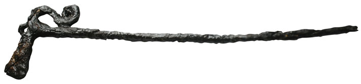
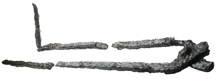
In one area inside the fortifications, the team found a trove of iron artifacts, the sheer number of which indicates that the site was one of the largest known metalworking complexes in sixth-century Britain. The objects include fragments of weaponry, pins, brooches, buckles, and tiny figurines resembling animals carved on Pictish stones, such as deer and hounds. The figurines may have been good-luck talismans or helmet decorations. One of the iron pins was shaped like the ax carried by the Rhynie Man. “For us, the exciting thing is that we can relate the material culture to the iconography on the stones,” says Noble.
These symbols and the evidence of feasting associated with the Rhynie enclosure are hallmarks of a royal center and mirror the structure of contemporaneous kingdoms in Ireland. Most likely the kingdom would have stretched for many miles across the landscape, with land—perhaps including Tap o’ Noth—acquired through conquest and marriage. And like the elites living on Tap o’ Noth, those at the royal center at Rhynie would have been supported by the people living within the kingdom. “In return, a king could provide wealth and protection to local people,” says Noble. “In this period they were almost like cult leaders.”
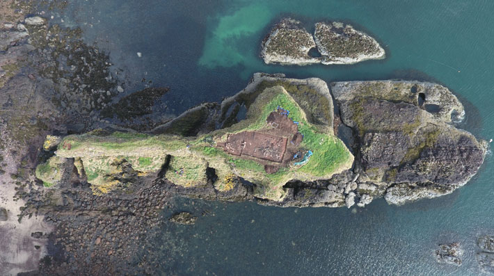
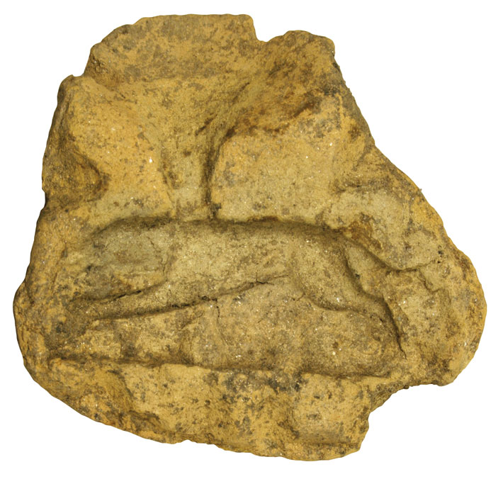
While the Picts in the Rhynie area were living off the riches of the land, others may have been taking to the waves. Between 2015 and 2017, Noble and his colleagues from the Northern Picts Project carried out a high-risk excavation on Dunnicaer—a towering isolated column of rock known as a sea stack about 20 miles south of Aberdeen. In the nineteenth century, adventurous youths found carved Pictish stones on Dunnicaer, but since then few people have visited this promontory, as it is cut off from the mainland at high tide and surrounded by sheer cliff faces. With the support of a professional climber, members of the team ventured onto the sea stack over three seasons to excavate what they believed might be a significant Pictish site.
At the top of Dunnicaer, they uncovered the remains of a promontory fort that had a timber rampart enclosing a number of buildings. Radiocarbon dating of the timber indicated that the fort was occupied during the third and fourth centuries A.D. Unlike the contemporaneous oval dwellings on Tap o’ Noth, the buildings at Dunnicaer were rectangular in shape, hinting at the influence of Romans, whose houses were typically rectangular or square.
The discovery of five sherds of Roman pottery, including one of fancy Roman tableware known as Samian ware, and six fragments of Roman glass further confirm that the Picts at Dunnicaer interacted with the Romans during their occupation of Britain. One of the fragments, a deep blue sherd of glass that most likely came from a rare hemispherical cup, suggests that people of high status may have traded with each other.
Roman sources record numerous skirmishes and battles with the Picts, but perhaps the best known is the so-called Barbarian Conspiracy, which occurred during the winter of A.D. 367. The exact course of events isn’t clear, but it seems that the Roman garrison guarding the northern frontier rebelled, allowing Pictish war bands to enter Roman Britain. Together with other groups that attacked by sea, including Gaels from Ireland and Saxons from Germany, the Picts overwhelmed loyal Roman forces, raiding far to the south and seizing control of most of the island until imperial reinforcements arrived the following year. The fourth-century A.D. Roman historian and soldier Ammianus Marcellinus describes the events in detail, but his account was written more than 20 years later while he was living more than 2,000 miles away in in Anatolia. Given how far apart the Picts and their allies lived, scholars have been skeptical that they really were as organized and successful as Ammianus would have us believe.
But because of his recent finds, Noble is now inclined to think that the Romans might not have been exaggerating. “Sites like Tap o’ Noth are showing that Pictish population centers were far bigger than we previously thought, and the artifacts we are finding show that they had a hierarchical society, were organized, and were tied into widespread networks,” he says. “It could be that sites like Tap o’ Noth and Dunnicaer were mustering troops and launching those raids.” Dunnicaer itself would have been particularly well suited for launching sea raids. “Perhaps what we had viewed as Roman propaganda and stereotypes have more truth to them than we thought,” says Evans.
During the sixth century, the Picts underwent a profound change. The Venerable Bede, a Northumbrian monk who lived from around A.D. 673 to 735, describes how, in the late sixth century, the Irish abbot and missionary Columba converted the Picts to Christianity. How quickly the Picts gave up their pagan ways and whether Columba was single-handedly responsible for their conversion is open to question. But their eventual transition from a pagan culture to a Christian one was marked by a striking change in the style of their carved symbol stones. After the sixth century, these monuments included depictions of the Christian cross and featured intricate interlacing designs and knot-work patterns that were most likely influenced by Christian manuscript art.
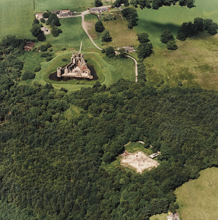
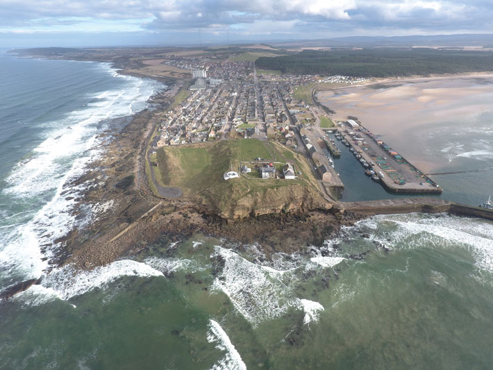
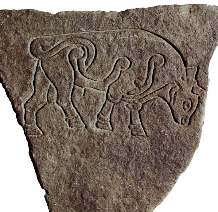
As Christianity continued to spread northward, many Picts seem to have developed a hybrid belief system. The coexistence of pagan and Christian traditions is evident at the small town of Burghead, located on a peninsula that juts northwest into the Moray Firth. Nineteenth-century excavations there uncovered timber ramparts more than 26 feet wide and 20 feet high. The residents of this 13-acre Pictish settlement clearly practiced both pagan and Christian rituals. Thirty carved stones decorated with depictions of bulls were found at the site, suggesting that some of its inhabitants belonged to a pagan bull cult. Scholars believe a well at Burghead could have been sacred to a pagan water cult. The discovery of fragments of ornate stone crosses and Christian shrines at the site suggest it was an important Christian center beginning in the eighth century A.D.
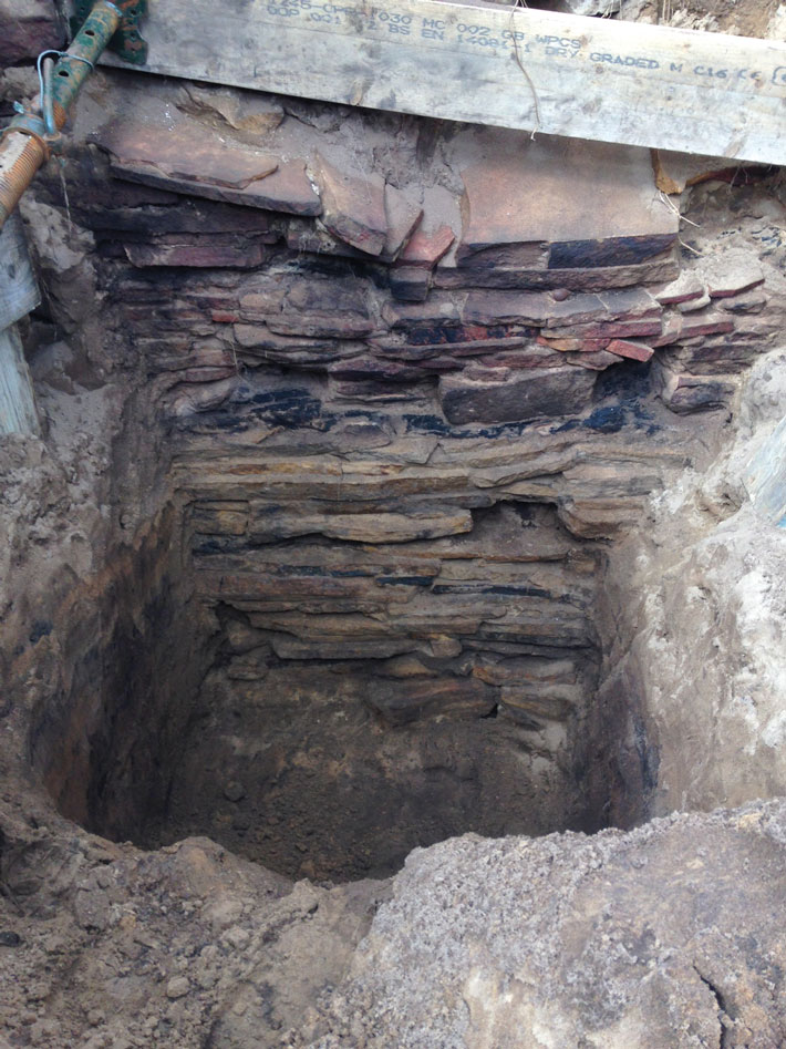
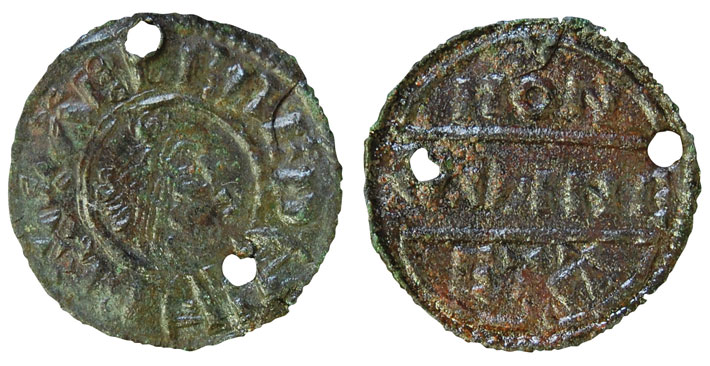
In 2018, Noble and his team carried out excavations on the tip of the fast-eroding promontory. They found intact floor layers under the windblown sand, surrounded by stretches of well-preserved timber ramparts—some as much as 10 feet high. Among the artifacts they unearthed was a pair of pierced Anglo-Saxon coins of Alfred the Great (r. A.D. 871–899), perhaps worn on a necklace or bracelet. Researchers believe the coins may have been brought north by Vikings who, beginning in the ninth century, were carrying out extensive raids across Britain. “We know that the Picts fought the Scandinavians in the 860s and 870s,” says Evans. “These coins might have been trophies or gifts from interactions with the Scandinavians, and they suggest that there were Vikings at Burghead, or at least that they were dealing with the Picts.” Radiocarbon dates show that the fort was occupied from at least the sixth through the tenth centuries. Burned timber beams suggest the site was eventually destroyed by fire.
Exactly what became of the Picts is still unknown, but Burghead may well hold some answers. “We suspect that the Picts amalgamated with other groups including the Scots [Gaels] and unified their kingdoms in the face of the threat of Viking invasions,” says Noble. Pictish kingdoms became Gaelic, and their people adopted the Gaelic language and culture. From the tenth century onward, the Picts disappear from the historical record, and this Gaelic-speaking land, broadly corresponding to today’s northern and western Scotland, is referred to in English texts as the Kingdom of Alba, or Scottaland.