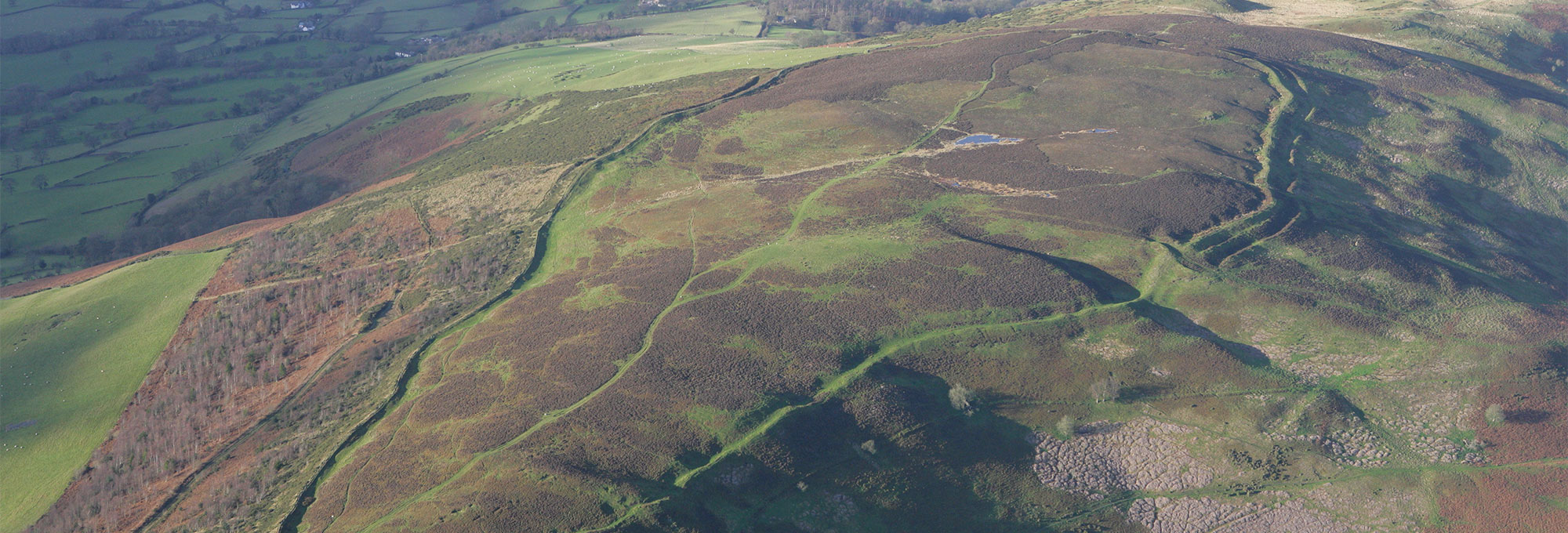
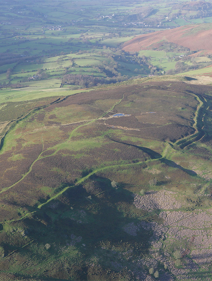
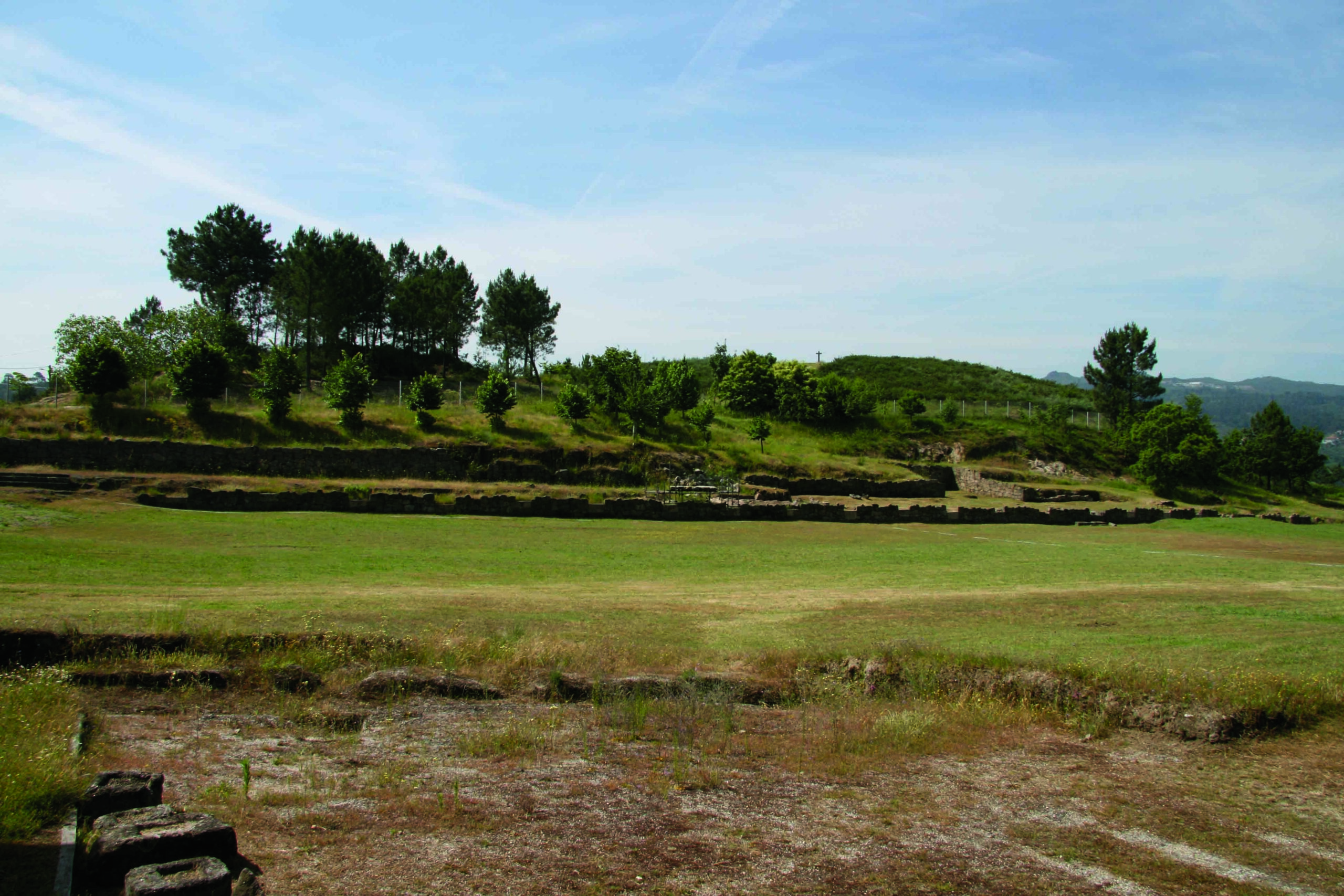
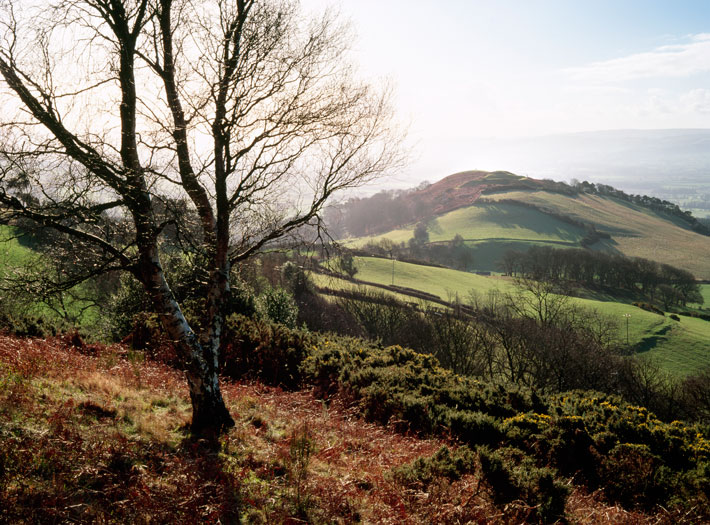
In late summer, the heather on the bleak, windswept moorlands of the Clwydian Range blooms deep purple. A series of hills and mountains in northeast Wales, not far from the English border, the Clwydians are today a popular destination for hikers who share trails with flocks of grazing sheep. Those making the arduous scramble to one of the summits are rewarded with views that take in much of Wales and northern England, including the craggy mountains of Snowdonia to the west and the distant peaks of the Lake District to the north. Below the range, the Vale of Clwyd (pronounced KLOO-id) stretches out like a green and yellow patchwork quilt, the boundaries of farmland marked by tidy lines of trees. This bucolic landscape belies the fact that dramatic events played out here some 2,800 years ago. Around that time, people were transitioning from the Bronze Age to the Iron Age and, under circumstances that are still not entirely clear, built a series of enormous enclosures called hillforts, whose origins and ultimate purposes are, for now, lost to time. Archaeologists are currently excavating at hillforts in the Clwydian Range to understand both their construction and the conditions that convinced people to come together and pool their labor to erect these monumental feats of prehistoric civil engineering.
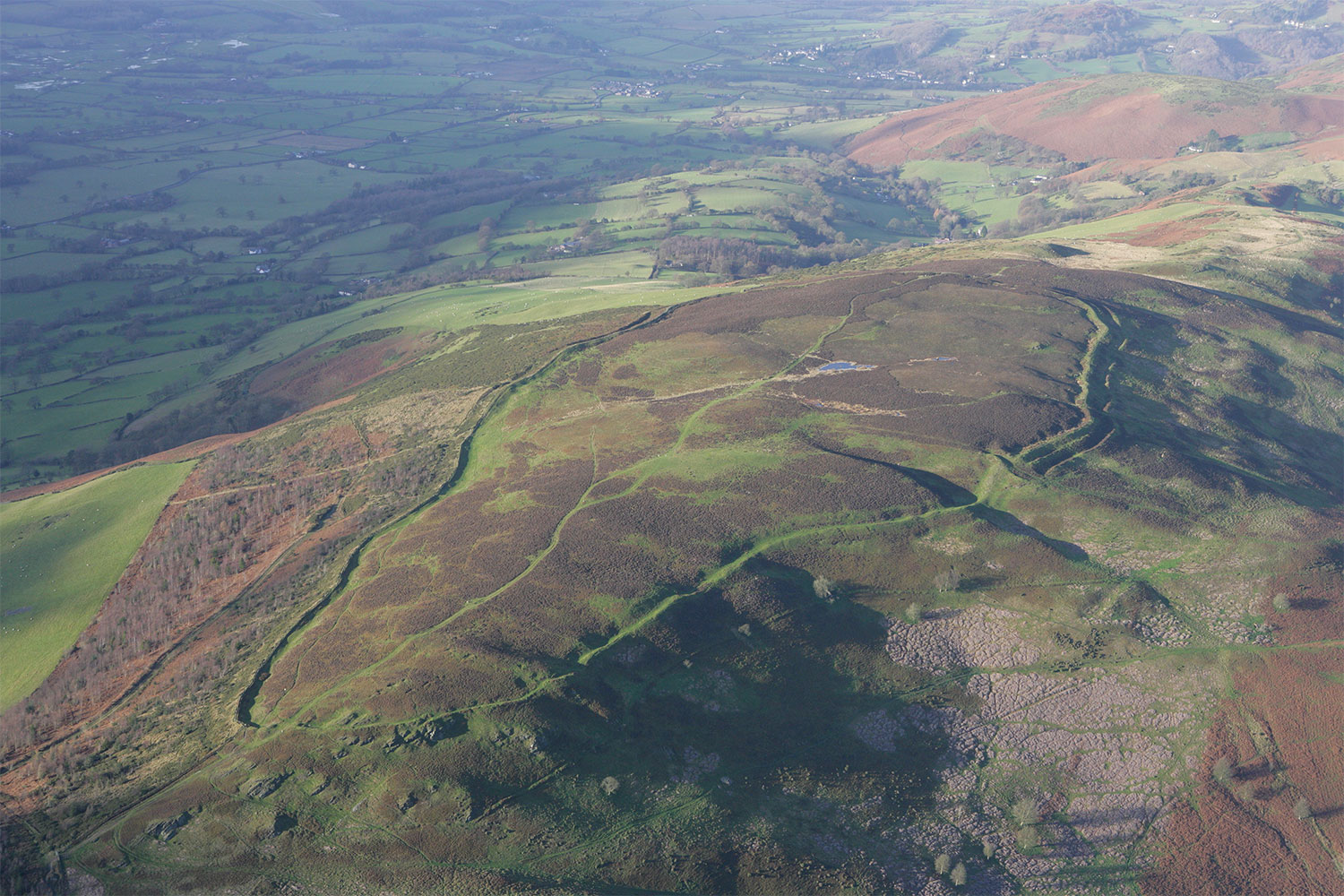
Sited on hilltops of varying elevations, and differing widely in size, hillforts feature deep ditches and earthen and stone ramparts that were probably topped by wooden stockades. The sheer size of the sites has drawn the attention of archaeologists since the nineteenth century. Much of what we know about hillforts in the British Isles comes from excavations in southern England where many archaeologists think the majority of the sites were initially built between about 700 and 500 B.C. But Wales rarely figures in discussions about the Early Iron Age. “Wales was always considered the periphery. But the Clwydians have one of the densest concentrations of hillforts in Britain,” says University of Liverpool archaeologist Rachel Pope. “When we talk about understanding the Early Iron Age, it makes sense to try to come to grips with what people were doing here during that period.” Pope, in fact, suspects that some hillforts in northern Wales may actually predate those in southern England. She is one of several archaeologists focusing on the Clwydian Range, and her team is currently excavating at the massive Penycloddiau (pronounced pen-a-KLAW-thee-eye) hillfort. It is the largest such site in Wales, encompassing some 60 acres. By one calculation, 10,400 trees would have been felled during its initial construction.
Another group, led by University of Oxford archaeologists Gary Lock and John Pouncett, has been digging for five years at a nearby site, the five-acre Moel-y-Gaer, Bodfari. Lock notes that the search for evidence in the Clwydian Range is challenging because the same acidic soil that allows blooming shrubs such as heather to thrive also makes preservation of bones and artifacts extremely rare. “You don’t get involved with the Welsh Iron Age if you want clear answers,” says Lock. Compounding the difficulty, he says, is the fact that the people living in northern Wales during the Iron Age mysteriously abandoned the use of pottery, an archaeologist’s favorite means of studying cultural change through time.
What scholars do know about the Early Iron Age in northern Wales and across the rest of Britain is that it was a time of profound cultural change. During the Late Bronze Age, from about 1000 to 800 B.C., people buried magnificent bronze artifacts in hoards that archaeologists interpret as symbolic burials celebrating the wealth of high-status individuals. This practice had come to a halt by around 800 B.C. “The whole thing suddenly collapses,” says Lock, “and then you get the rise of the hillforts.” These structures, which had to have been built by large numbers of people acting together, were made throughout the British Isles, most predominately in a wide swath of land extending from northern Wales south to the English Channel. In the past, scholars thought hillforts were a response to increasing violence, and that this zone represented an unstable border region where conflict or political instability was particularly acute. But Lock and others now feel that while they may have had defensive purposes, they signal, more importantly, a shift in the culture’s values. “In the Early Iron Age we see a change from people celebrating high-ranking individuals to marking the importance of larger communities,” says Lock. “Whether we call them tribes or something else, it’s clear that larger groups are coming together in this period and building hillforts. They supplant bronze hoards in the archaeological record, and that can’t be a coincidence.”
Many hillforts do show signs of being built for defensive purposes, and their locations, with many of them near passes or river valleys, suggest they were built to dominate strategic points on the landscape. But no two hillforts are alike. Some excavated hillforts have evidence of streets and houses that suggest permanent occupation, while others don’t seem to have had sufficient structures for regular, long-term use. These were perhaps employed by wider communities to meet, trade livestock, and participate in ceremonies. Multiple entrances at some hillforts suggest to archaeologists that some were intended for ritual processions.
Another possible explanation for the rise of hillforts is that they were a way for people to cope with climate change. For most of the Bronze Age the climate was milder than it is in Britain now, but some data suggest that it became cooler around 800 B.C. The decline in temperature wasn’t gradual, but rather was a sudden shift that would have been noticeable to farmers who could have seen the growing season shorten within a lifetime. “On the western coast of Britain, the effects of the change might have been felt first,” says Pope. “It’s possible that people first began to build hillforts here as part of their effort to deal with the climatic shifts.” She posits that Iron Age people may have come together in the hillforts during this period and formed super-households of a number of families in order to safeguard livestock and pool resources. The debate over the uses of hillforts may never end, but each one has its own story to tell. That makes excavation of largely ignored sites, such as those in northern Wales, all the more important in unraveling the mystery of what happened in the British Isles during the beginning of the Iron Age.
Archaeologists have dug at the hillforts atop the Clwydians sporadically since the nineteenth century, and attention to the area’s Iron Age landscape was renewed in 2008 when regional archaeologist Fiona Gale helped organize the Heather and Hillforts project. A government-funded effort aimed at cataloguing and protecting the range’s rich natural and archaeological resources, the project lasted four years and involved detailed surveys of six hillforts, including Penycloddiau. Archaeologists also conducted limited excavations at damaged sections of some of the hillforts’ ramparts and developed plans to control erosion at the sites most at risk. Gale hoped that by collecting basic data on hillforts, she could help set the stage for more intensive future excavations. “The acidic soil is such a challenge to archaeology,” she says. “But I felt sure that our project would lay the groundwork for other digs that could help us understand what happened here in the Iron Age.”
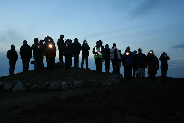
The project’s other important goal was raising the profile of the hillforts among the public. In 2011 archaeologist Erin Lloyd Jones organized a novel event called the Hillfort Glow experiment. Lloyd Jones studies the relationship of hillforts to each other, and wanted to test the “intervisibility” of the sites in the Clwydian Range and in the neighboring Cheshire region. “We wanted to look at the hillforts not in isolation, but in terms of their connections to each other,” says Lloyd Jones. To that end, she arranged for around 350 volunteers to climb 10 separate hillforts at nightfall, some at a distance of up to 16 miles from each other. At a prearranged time, the volunteers signaled to each other with high-powered “newt torches,” flashlights that naturalists use to search for newts at night, as proxies for beacon fires. “It succeeded beyond our wildest expectations,” says Lloyd Jones. “We could see hillforts that you have trouble seeing in the daylight. That I didn’t expect.” She hastens to point out that it is impossible to know if all the hillforts were occupied at the same time, since radiocarbon dates are difficult to come by in northern Wales, another casualty of the region’s acidic soils. But the experiment demonstrated that contemporaneous sites across a wide area would have at least been aware of each other, and may have been knit together across a landscape they shared and strove to dominate. Interestingly, many of the numerous local myths and legends dealing with hillforts involve giants, and may be a reflection of how their sheer size has continued to impress people. “If you think about it, even abandoned hillforts must have played a role in later peoples’ lives,” says Lloyd Jones. “Just look at how big a presence they are today, more than 2,000 years later.”
In 2010, while the Heather and Hillforts project was still under way, Gary Lock was teaching an extension class at the University of Oxford on Iron Age hillforts. An expert in the period who is putting together a comprehensive atlas of hillforts in the British Isles, Lock has delivered many lectures on the topic and, at the end of the class, was ready to answer the usual questions he is peppered with by fans of archaeology. But he was unprepared for one question. “A gentleman came up to me and said, ‘How would you like to excavate a hillfort in Wales?’” Lock laughs, still astonished at the memory. “That never happens.” As it turned out, the hillfort of Moel-y-Gaer, Bodfari, had been in the family of the man’s wife, Banba Dawson, for more than 100 years. Her father had been a scientist, and he had long been curious about the hillfort and interested in its protection. Dawson invited Lock and his team to work at the site, which is on a steep hill that rises some 600 feet above the small village of Bodfari, not far from the six sites included in the Heather and Hillforts project. Ringed by two ditches and a pair of formidable ramparts, Moel-y-Gaer, Bodfari, was originally excavated in 1908, but had been left largely undisturbed since.
The site differs from those included in the Heather and Hillforts project in that it sits at a low altitude. Its location, though, must have been irresistible in ancient times. Moel-y-Gaer, Bodfari, sits above the confluence of two rivers and guards an important pass through the range. “It’s a strategic position,” says Lock. “From here they could have controlled much of the movement into and through the Vale of Clwyd.” It may be the lowest lying of the hillforts, but when viewed from below, the scale of the ramparts dominates the landscape.
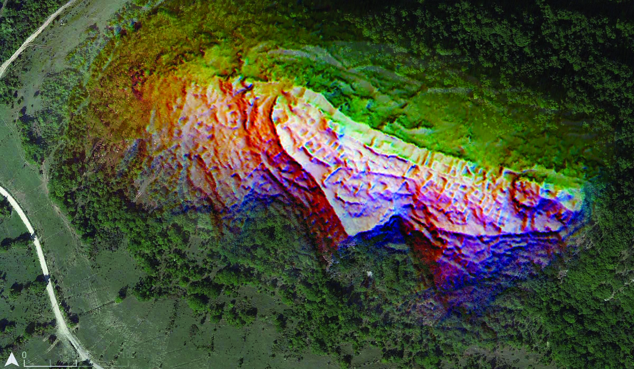
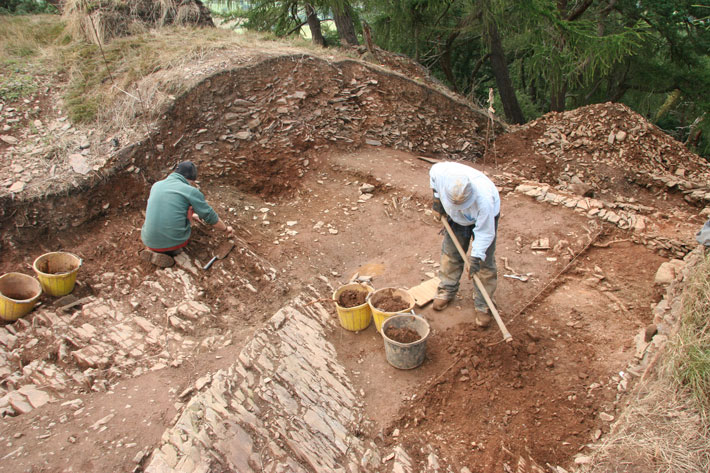
Now in their fifth year at Moel-y-Gaer, Bodfari, Lock and his crew are concentrating on two areas, digging sections of the rampart and ditches to understand the sequence of construction, and unearthing the remains of a large structure within the enclosure known as a roundhouse. The team has so far unearthed the remains of a 10-foot-deep ditch— much bigger than expected—cut into the bedrock. They have also exposed a series of stone foundations for ramparts that show they were repaired or rebuilt multiple times, indicating the site may have been in use for a long period.
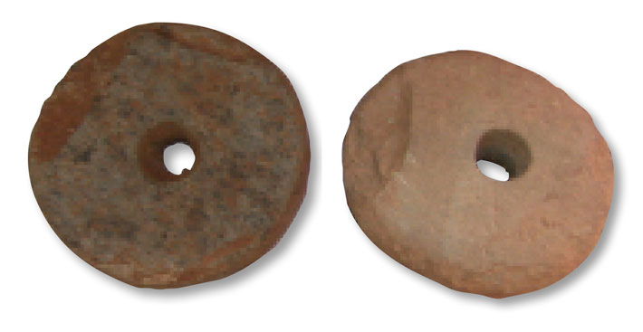
This season, the team discovered charcoal near the base of one of the foundations, which gives them hope that they might get an elusive radiocarbon date in the near future. They have also excavated much of the roundhouse, which was identified through remote sensing, but have thus far discovered only two artifacts, a pair of stone spindle whorls. The objects demonstrate that weaving, a domestic activity, took place on the site. John Pouncett, Lock’s coinvestigator, says that indicates that at least a few people probably lived there. “The spindle whorls also tell us that the people raised sheep and that the hillfort was used to secure livestock,” he says. “These objects take us outside the hillfort and help us understand how it was connected to the surrounding landscape, which is largely agricultural now and likely was then, too.”
The team plans on another five years of excavation of the site’s surprisingly intricate ramparts. “Our work thus far has shown there was a massive investment of time and labor at Bodfari,” says Lock. “Looking at the ramparts you don’t really get a sense of how complex they are, but excavation shows how much work they took to construct.” Iron tools didn’t appear in large numbers in Wales until late in the Iron Age, meaning that the backbreaking work of digging the deep ditches and constructing the ramparts would have been done with bone and antler tools. Given the time and resources that would have been involved in building the hillforts, Lock believes they could only have been constructed by a large alliance of family groups in the surrounding countryside coming together.
One of the most exciting finds of the last season was a single piece of bone, possibly from the skull of a sheep or goat, discovered in the roundhouse. It’s a small but telling piece of evidence. “There’s no way to know for sure,” says Lock, “but it could have been left behind after a ritual feast, when the larger community came together to celebrate an event, and we may be able to radiocarbon date it.”
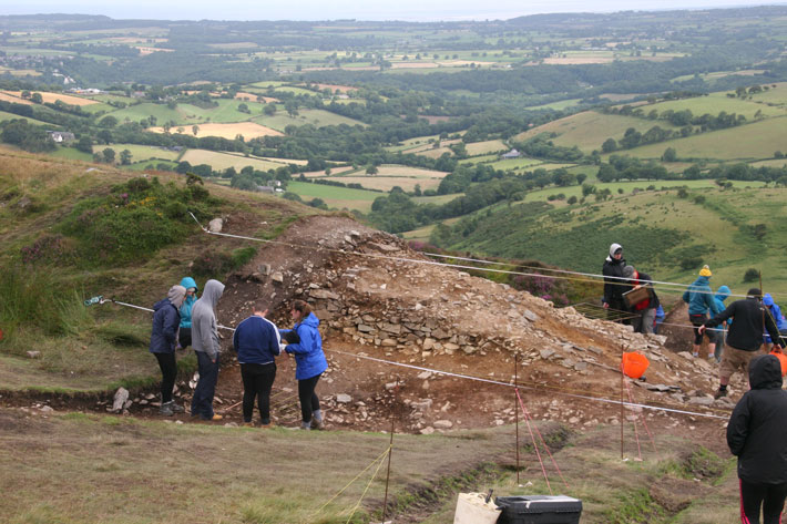
Penycloddiau is no more than four miles from Moel-y-Gaer, Bodfari, but it is much higher, at an elevation of almost 1,500 feet. Even in July, the summit of Penycloddiau is a cold place to be, buffeted by wind and rain that must make the hundreds of students who participate in the excavations here wonder how the Iron Age people ever found the spot appealing. Under the direction of Rachel Pope, this season the students are excavating a rampart at the east entrance to the hillfort, and have exposed chaotic and dense layers of rocks. As at Moel-y-Gaer, Bodfari, there is evidence that the rampart was repaired or reconstructed, possibly over a long period of time. Not far from the ramparts, another group of students is digging a roundhouse, carefully scraping away minute layers of earth in search of material that could yield radiocarbon dates. The dwelling is one of 70 roundhouses that have been identified on Penycloddiau. Unlike Moel-y-Gaer, Bodfari, the site must have been home to a large population by the standards of the time.
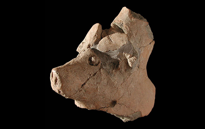
No artifacts have been discovered at the site yet, which doesn’t surprise Pope, and not just because the soil in the Clwydians makes preservation difficult. “In the late Bronze Age, you have all this wonderful experimentation in the material culture,” says Pope. “Then something happens to change that. The Early Iron Age sees much less of that experimentation. You of course have the hillforts, an effort to make a statement on the landscape, but they are low in material culture. It must have been a harsher time.”
Pope’s team will excavate at Penycloddiau for two more seasons. Their work so far has helped enable them to understand the construction sequence of the site’s ramparts. Pope’s codirector, Rich Mason, has also discovered evidence of a previously unknown entrance due west of the one they are currently excavating, suggesting that Penycloddiau had multiple ritual entrances that were used during celebrations. And while hard evidence for an early date of the hillfort remains elusive, Pope points out that the period was a complicated time that would have been experienced differently by people living in northern Wales. “We need to understand the region on its own terms,” says Pope. “After the excavations here and at Bodfari are complete, we’ll have a better understanding of the Iron Age in the Clwydians, which has been such a black hole for us.”

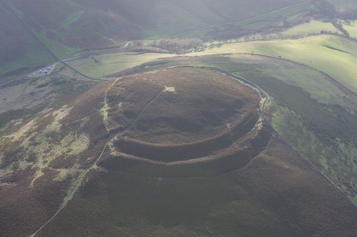
To appreciate the scale of Penycloddiau, it pays to make the steep hike up Moel Arthur, a hillfort just two miles south. Likely named sometime in the Middle Ages after the legendary British king, the site has a more overtly defensive feel than the other hillforts in the range. On the north and east sides, two imposing, heather-clad ramparts still stand as high as six feet. It’s not hard to imagine them patrolled by warriors during times of crisis. At the same time, the vistas would have made a magnificent backdrop to rituals.
From the top of Moel Arthur, Penycloddiau dominates the view to the north. As Pope says, the site seems like a bold statement on the landscape, broadcasting a message that is muted to us today, but one that must have been clear to its Iron Age builders. Whatever the cultural nuances of that message, the once-mighty ramparts of the hillforts still impart a sense that whatever their troubles, Iron Age people once endured and even thrived here.
Video: Moel Arthur Hillfort
One of the smallest hillforts in Wales' Clywdian Range, Moel Arthur might be one of the earliest ones built. Based on archaeological data, this animated reconstruction commisioned by the Denbighshire County Council shows how the site appeared over many hundreds of years from the first moment it was constructed to its abandonment.
Video: Penycloddiau Hillfort
The largest hillfort in Wales, Penycloddiau was likely occupied for many generations. Based on archaeological data, this animated reconstruction commissioned by the Denbighshire County Council shows how the site might have appeared during the first millennium B.C.


