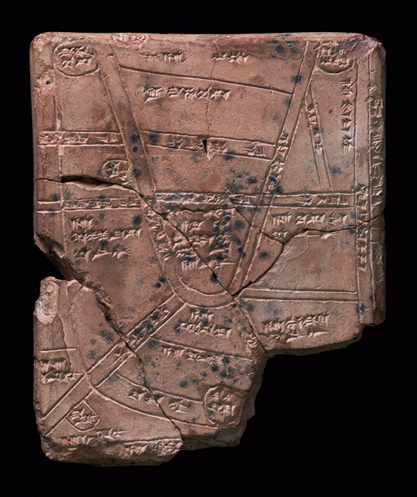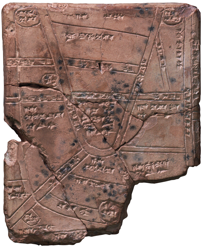
For the busy farmers of the Babylonian sacred city of Nippur, ready access to water was essential. It’s hardly surprising, then, that this tablet, which maps an area near the city, features a complex irrigation network of ditches and canals, depicted by lines, along with a number of towns and agricultural estates, represented by circles. What is somewhat surprising, though, is that a map of the area was produced at all. Landholdings in Mesopotamia were typically described rather than drawn, explains Philip Jones, a curator at the Penn Museum. “It’s difficult to put your finger on why this map was created,” he says, “but it must have been for some administrative purpose.”
The map’s central section, identified in cuneiform writing as a “field of the palace,” suggests that the tablet served as a guide to estates belonging to the recently established Kassite Dynasty, which was based in the city of Babylon, around 70 miles northwest of Nippur. At this time, the region’s new Kassite rulers were challenging the religious establishment in Nippur, which had long been the seat of the chief Sumerian god, Enlil. The top center section of the tablet includes an estate and field of Marduk, the patron god of Babylon. Says Jones, “What we see here is that Marduk is beginning to usurp Enlil’s place and is actually getting land within Enlil’s own city.”


