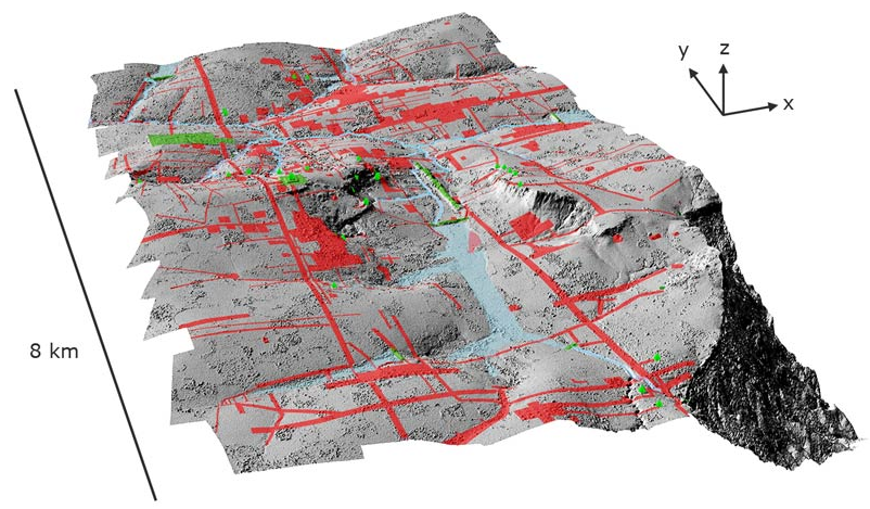
SIEM REAP, CAMBODIA—Information gathered by remote sensing equipment known as LiDAR shows that the city of Angkor, founded in 802 A.D. as the capital of the Khmer Empire, was the world’s largest urban network until the Industrial Revolution of the eighteenth century. Damian Evans of the University of Sydney’s Robert Christie Research Center in Siem Reap says that the project, which was funded by the Khmer Archaeology LiDAR Consortium, fills in blank spaces on the map of Angkor. “While a lot of the city is buried beneath the ground, it impacts the surface in subtle ways. ...None of these lumps and bumps and dips made any kind of sense, but once you see the LiDAR imagery, it’s strikingly evident that what you’re looking at are the remains of a city associated with Angkor Wat,” he said.