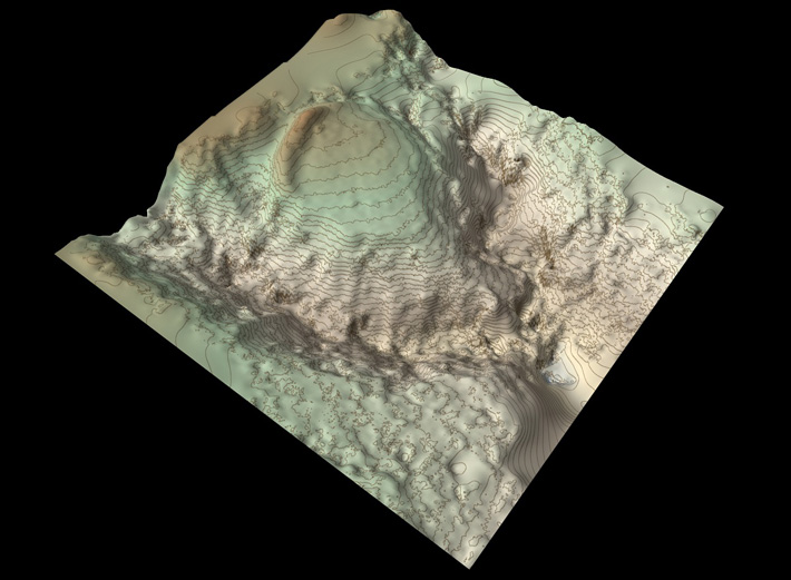
DUMFRIES AND GALLOWAY, SCOTLAND—BBC News reports that archaeologist Matt Ritchie of Forestry and Land Scotland and a team of researchers conducted a new aerial survey of an earthen rampart and promontory in southern Scotland known as Wallace’s House. In a nineteenth-century survey compiled from information provided by local ministers of the Church of Scotland, the site was described as a stronghold used by William Wallace, who fought for Scottish independence from the English in the late thirteenth and early fourteenth centuries. Ritchie said the team members used a drone to take hundreds of photographs of the site, and combined them with computer software to create a 3-D model of the terrain. “There isn’t much evidence on the surface, but the rampart and topography matches the historic description very well,” he said. “But could the fort really have been built by William Wallace and his men?” Ritchie asked. “I’d like to think so—and either way, the survey has added a new chapter to an old story.” To read about a pivotal battle in the fight for Scottish independence, go to "Bannockburn Booty."


