Rome’s Aqueducts Mapped With High-Tech Tools

News October 29, 2013

(Courtesy Ted O’Neill)
SHARE:
rome aqua traiana aqueduct carestia7
(Courtesy Ted O’Neill)

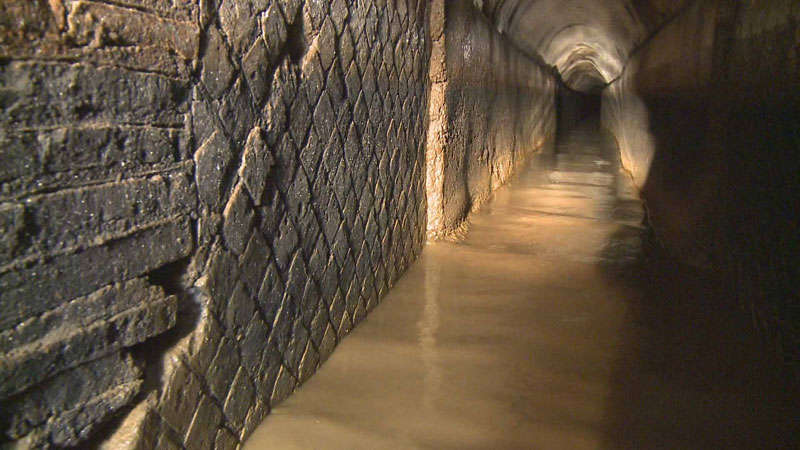
VICOVARO, ITALY—Speleo-archaeologists are using GPS technology, remote control robots, and laser rangefinders to update the maps of Rome’s 11 ancient aqueducts that were compiled between 1906 and 1925 by British archaeologist Thomas Ashby. The carefully engineered aqueducts used gravity to carry clean water into the city. “Water was a fundamental service for hygiene. In a city like Rome, which had a million inhabitants, there were very few epidemics,” said Riccardo Paolucci of the group Underground Rome.  

  • Features September/October 2013

    Tomb of the Vulture Lord

    A king’s burial reveals a pivotal moment in Maya history

    Read Article
    (© Kenneth Garrett)
  • Letter from Norway September/October 2013

    The Big Melt

    The race to find, and save, ancient artifacts emerging from glaciers and ice patches in a warming world

    Read Article
    Norway melting ice patch
    Courtesy Oppland County Council, Photo: Johan Wildhagen/Palookaville
  • Artifacts September/October 2013

    Roman Writing Tablet

    A tablet bearing a birthday party invite includes the earliest Latin script penned by a woman

    Read Article
    (© The Trustees of the British Museum/Art Resource, NY)
  • Digs & Discoveries September/October 2013

    No Changeups on the Savannah

    Read Article
    (Private Collection/J.T. Vintage/The Bridgeman Art Library, Werner Forman/Art Resource, NY, Pat Benic/Copyright Bettmann/Corbis/AP Images)