Three men are sitting on the aft deck of RV Storm, a 50-foot research vessel bobbing gently on Lake Huron on a clear, warm July morning. They’ve more or less disappeared under shrouds of black neoprene, masses of corrugated and smooth tubes, and constellations of metal tanks, clips, and fasteners. Dive safety officer Jason Nunn calls out a checklist that sounds arcane even to an experienced scuba diver:
“Press the ADV to ensure proper operation.”
“Confirm computers are set for CCR mode and that you’re on the appropriate mix.”
“Set your PO2 to 0.5.”
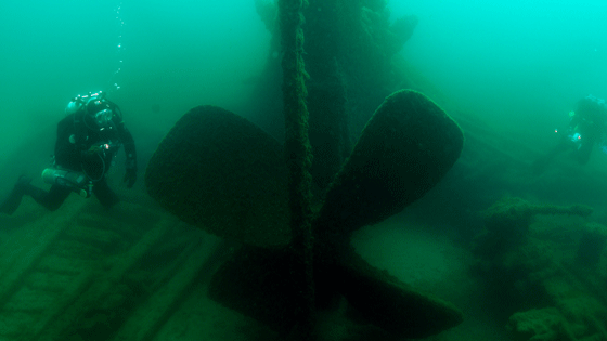
The divers—Russ Green, Joe Hoyt, and Tane Casserley—are underwater archaeologists with the Office of National Marine Sanctuaries of the National Oceanic and Atmospheric Administration (NOAA). They are wearing rebreather systems that scrub the carbon dioxide from their breath and recycle the air, allowing them to dive deeper and stay down longer than divers with traditional open-circuit scuba gear. In a few minutes, they will drop 165 feet through the clear, cold water to the wreck of Pewabic, a 200-foot-long freighter that sank in 1865 after a mysterious collision. Pewabic is one of hundreds of wrecks and suspected wrecks in the Thunder Bay National Marine Sanctuary off the northeast coast of Michigan. Together, these historic ships embody the entire history of modern transportation in the Great Lakes—the story of the opening of the American continent to settlement and industry.
“About 30 seconds to rail,” says Nunn, who is from East Carolina University, cueing the divers to approach the edge of the deck.
“I’ve been waiting all day for this moment,” says Hoyt, visiting Thunder Bay from the Monitor National Marine Sanctuary in Virginia, before he lumbers over. One after another, the divers step out and disappear.
Twenty-five minutes later, an inflatable bag surfaces a few yards from Storm. This is the signal to Nunn that the divers are all together, and the prompt for him to send out two safety divers—NOAA archaeologist Stephanie Gandulla and East Carolina University’s Mark Keusenkothen. A second bag pops up to signal that everything is okay and the divers are waiting 60 feet below for safety purposes.
“Business as usual,” says Casserley around 20 minutes later as he hauls himself back onto the deck, with no little effort, and begins the laborious process of removing his equipment.

To prepare to dive Lake Huron, even in the middle of July, is to set up defenses against the cold. Divers must don either dry suits like the ones the archaeologists wear or 7 mm wetsuits, thick and constricting enough to make raising one’s arms a chore. Casserley, who was used to diving in Hawaii, says it took him five years to get comfortable with diving these northern waters. “If it weren’t for all these wrecks…,” he says, trailing off and looking out over the lake. At depth, the water temperature can be just 36 degrees Fahrenheit. It slides down the back of one’s wetsuit like an ice cube. But that cold freshwater is the reason there is a sanctuary here. The conditions are amazing for the preservation of shipwrecks.
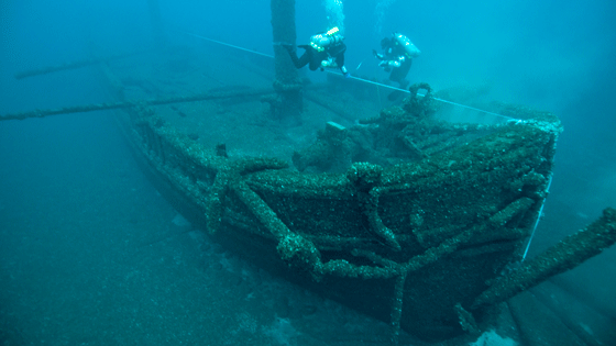
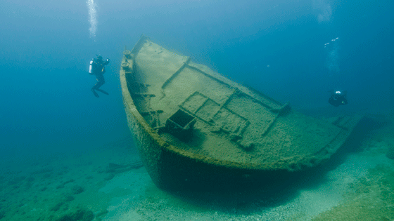
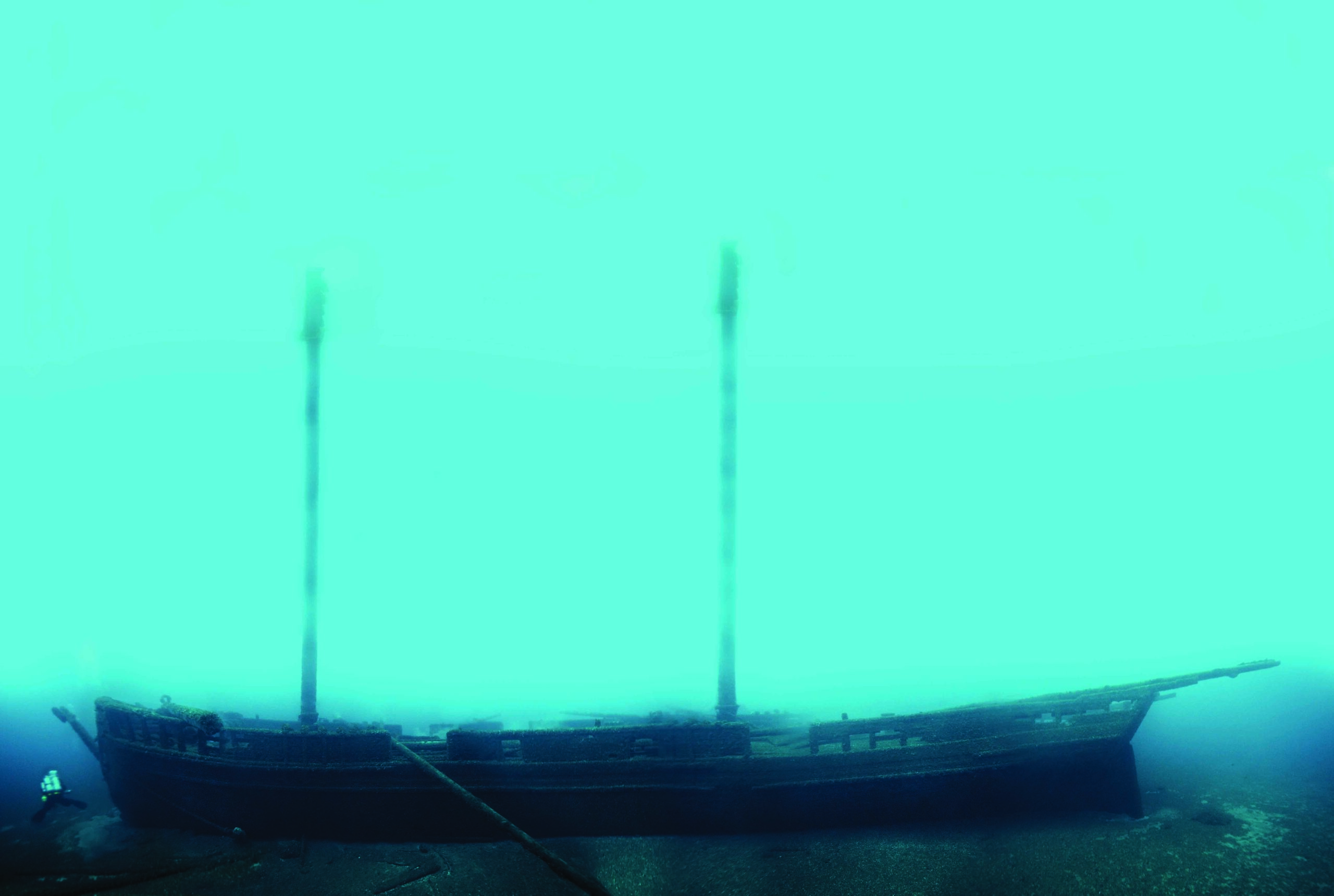
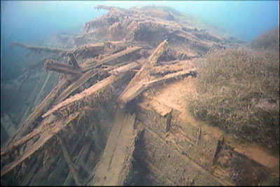
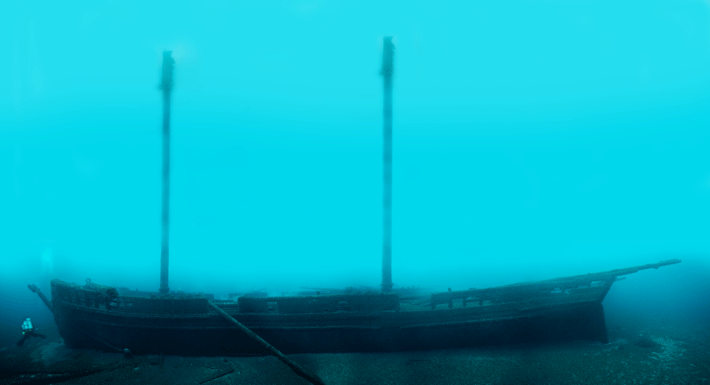
In the salty ocean, wooden wrecks typically get eaten away by shipworm and metal ones by rust, so they rarely look like ships anymore (with exceptions, such as the Vasa in the cold Baltic). But Lake Huron keeps them remarkably intact. Take Defiance and John J. Audubon, which collided and sank in 1854. Each sits upright on the lake floor, and both of Defiance’s masts are intact, rising more than 70 feet from the deck. Even encrusted in sea life, they look like they could have gone down yesterday.
“It’s a little overwhelming when a boat is intact on the bottom,” says Wayne Lusardi, underwater archaeologist for the state of Michigan, which comanages the sanctuary. Away from surface waves, scouring ice, and recreational divers, the deepest wrecks stay in good condition. As he puts it, “They stay lost longer.” And many, many boats were lost in this part of Lake Huron.
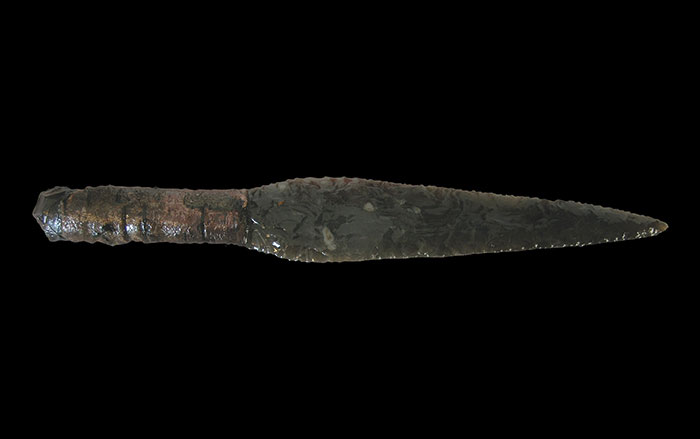
The Great Lakes—Ontario, Erie, Huron, Michigan, and Superior—formed around 10,000 years ago as retreating glaciers filled vast basins with meltwater. Together they make up the largest lake system in the world by surface area and hold one-fifth of the world’s surface freshwater. Before European colonization, Native Americans used the lakes for trade and communication. Later, colonial ships sailed their waters sporadically, followed by military vessels during the War of 1812. With the 1825 opening of the 363-mile-long Erie Canal, which connected the Hudson River with Lake Erie, shipping on the lakes began to grow rapidly. Throughout the nineteenth century, canals and locks were built to connect the lakes with each other (and the Mississippi River) and to bypass rapids and falls (including at Niagara). This made the transportation of people and bulk goods from the Atlantic coast to the interior safer and faster than ever before, at a time when the U.S. rail system was in its infancy.
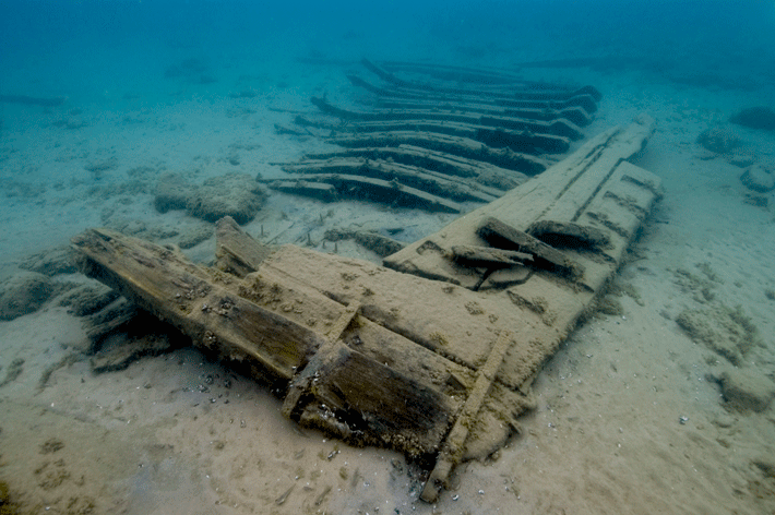
At first, these ships carried pioneers and package freight to and around the Midwest. Coal came up the system from Pennsylvania, grain from Minnesota and Wisconsin. Ore traveled down to Cleveland, Buffalo, and Detroit, and people and freight found passage to Chicago and points west. By the 1870s, 3,000 Great Lakes ships were registered in the United States, and another 1,000 in Canada. Over time, ornate sailing ships gave way to boxy, utilitarian schooners. Sail gave way to steam, and wood to steel.
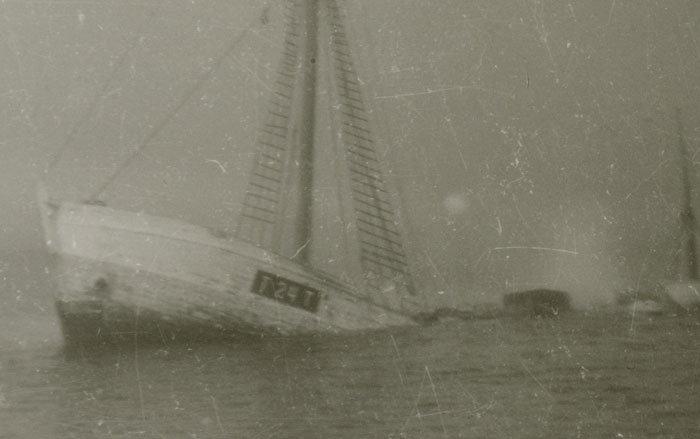
Thunder Bay, in northern Lake Huron, is in the middle of the Great Lakes waterway system, and so it sees the full range of passengers and cargo. “Everything that’s important,” says Green, “is coming by Thunder Bay.” That means traffic—and the congestion is exacerbated because Thunder Bay lies near a choke point. Ships traveling north through Lake Huron must make a sharp turn west to pass through the Straits of Mackinac into Lake Michigan. In an effort to save time and cut costs, captains often tried to cut this corner. Before shipping lanes were firmly established, a lot of ships’ paths converged in a small area. In addition, there are a number of navigational hazards and—as any Great Lakes native can attest—sudden, nasty storms. “They don’t call it ‘Thunder Bay’ for nothing,” says Lusardi. A single storm in 1913—known as the “White Hurricane”—claimed 12 ships and 248 lives. These ships were trying to make the last late-season runs before the lakes iced up. Some 60 to 70 percent of the ships lost near Thunder Bay went down in such early-winter rushes.
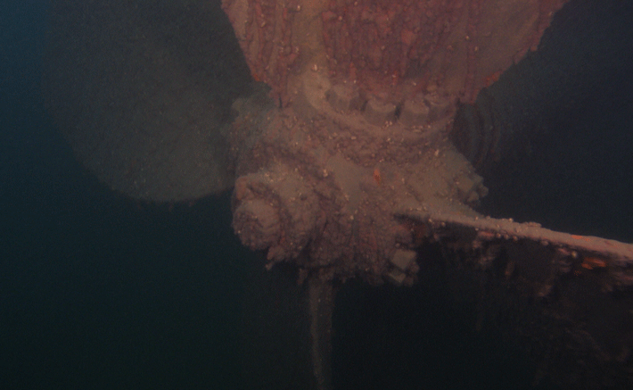
“It’s pretty amazing what lies beneath the lakes,” says Lusardi. “Most people have no idea how big the lakes are and how ferocious they can be and how they can just swallow things up.”
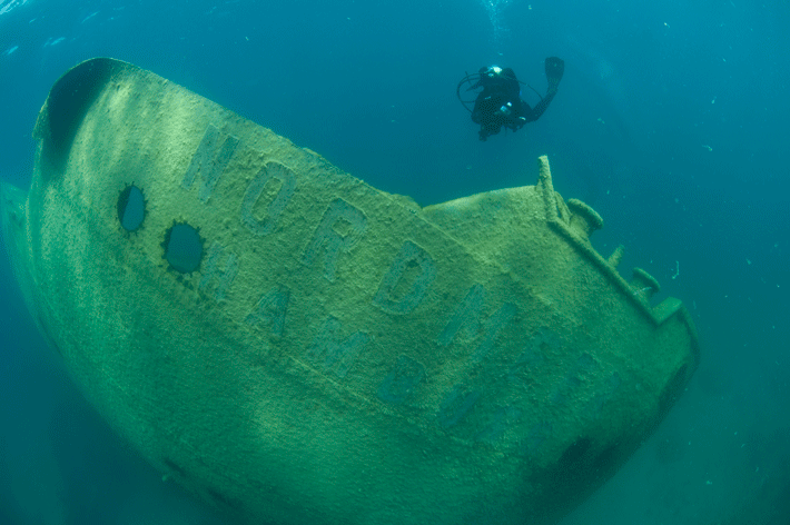
The oldest documented wreck in Thunder Bay is a wooden side-wheel steamboat called New Orleans that ran aground in 1849. The last ship to be swallowed up by these waters was Nordmeer, a 471-foot-long oceangoing German freighter, in 1966. Just 14 years later, Thunder Bay became a state underwater preserve. In 2000 it was designated a 448-square-mile National Marine Sanctuary, and in September 2014, the sanctuary grew almost 10 times in size to 4,300 square miles. The original sanctuary contained 45 known wrecks and 40 suspected ones. The new boundaries add 47 known and 60 suspected wrecks to those totals, many of which are in deeper water. Wrecks are still being found and identified.
The NOAA archaeologists have peeled themselves out of their gear and munch on apples and granola bars while Storm putters to another wreck site. They can afford to take their time, as they have a two-hour surface interval before they can dive again. They’re discussing wrecks, as they always do, the way one talks about old friends, each with its own long story of life as both ship and wreck. There are too many wrecks, especially in deep water, to study them all in detail, and the field season is short. So the archaeologists focus on documentation and monitoring. On Pewabic, they worked to create a photomosaic—probably their most common tool—of the entire wreck that will allow them to both examine details and assess how the site has changed over time.
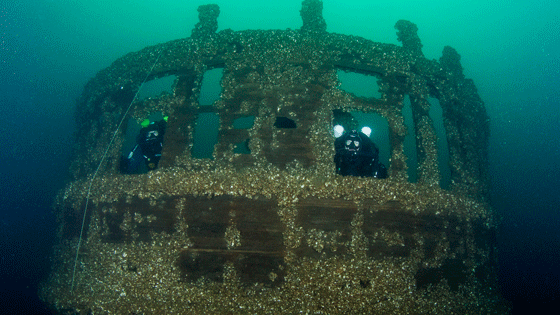
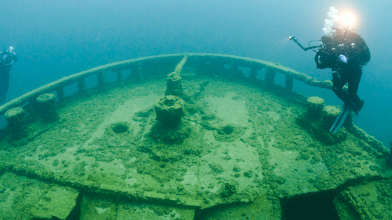
Pewabic ran from Cleveland to Lake Superior and back, carrying passengers and ore. The ship was passing Thunder Bay in 1865 with a load of copper and iron, when it steamed close enough to its sister ship, Meteor, to pass mail and news, as ships often did. For an unknown reason, Pewabic cut suddenly across Meteor’s path, and the collision left a gaping hole in its port bow. Pewabic sank in minutes, killing at least 35 passengers and crewmen. Over the years, several attempts were made to retrieve its valuable cargo of 1,000 tons of copper ore. But it wasn’t until 1917, during World War I, that salvagers using a bucket crane were able to extract 80 percent of the copper on board, destroying the ship’s cabins but leaving the hull intact.
Phil Hartmeyer researched Pewabic for his thesis in maritime studies at East Carolina University and now is on staff at Thunder Bay. The NOAA archaeologists examine and document wrecks and then make them available for more in-depth work. “By bringing other people into the research, we can compound the value of the work we do,” says Jeff Gray, superintendent of the sanctuary.
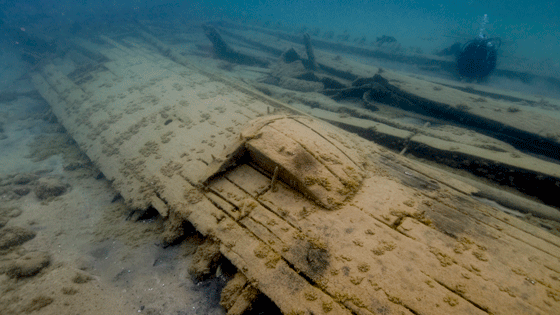
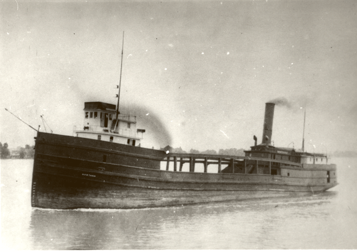
The NOAA team and their partners examine how ships changed over time, which was not always documented in any detail. Great Lakes ships, not subject to the battering that oceangoing vessels endure, might last 70 years, during which time they may be altered or repurposed multiple times. This was the case with Montana, another ship that the team has examined and is mapping in detail by hand. When it was built in 1872, Montana was a package freighter with relatively luxurious passenger cabins on top. Over the years, the cabins were removed, which allowed the ship to carry great stacks of lumber on its lower deck. The ship that sank after a fire in 1914 hardly resembled the original.
The ships evolved while they were in use, and have continued to change since becoming wrecks. For most sites, especially those in deep water, where dive time is heavily restricted, monitoring this change is as much as the archaeologists can do. “There are just too many wrecks here and you have to prioritize,” says Lusardi. “The summers are short and it takes a lot to mobilize.”
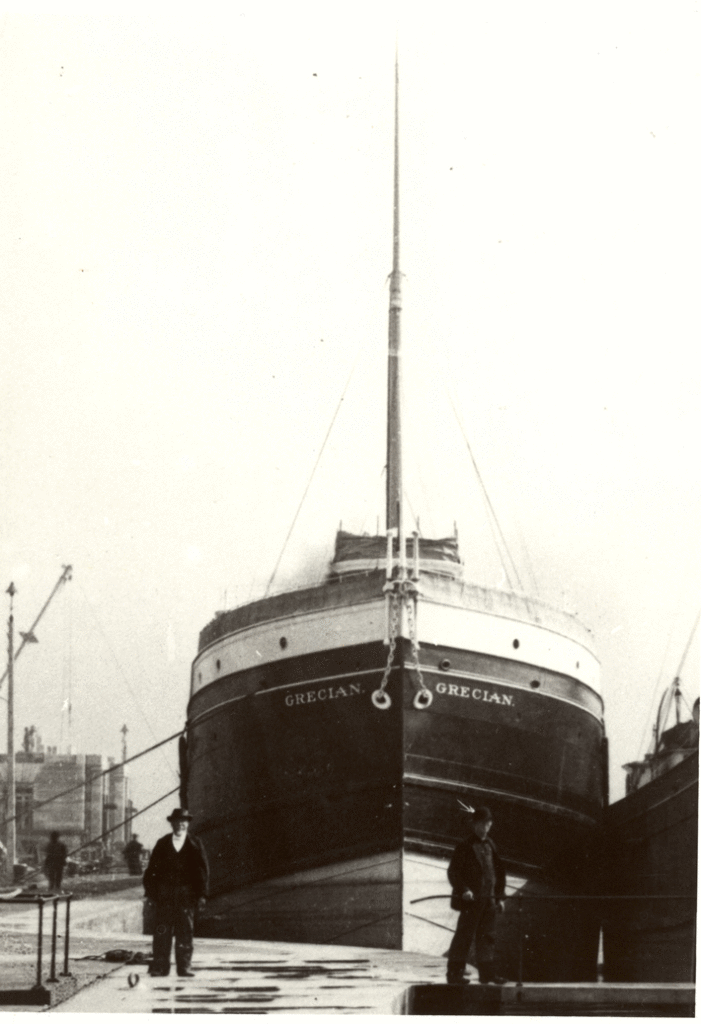
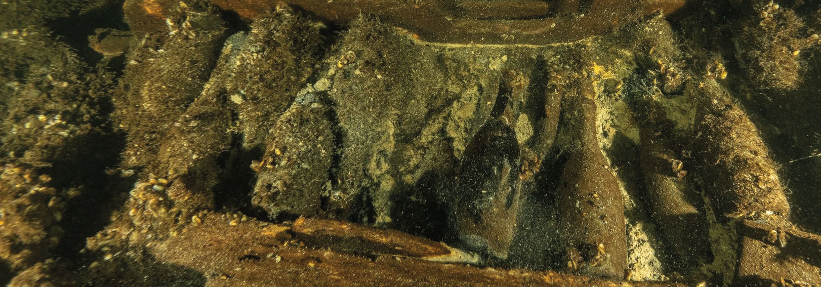
Though the wrecks remain well preserved, Lake Huron is a dynamic environment, and the last decade or so has seen sweeping ecological changes in the Great Lakes. The St. Lawrence Seaway, which connects the Great Lakes to the Atlantic via Montreal, opened in 1959 and provides lake access to deep-draft oceangoing vessels. These ships brought stowaways: In the late 1980s, zebra mussels, small aquatic invertebrates native to Russian lakes, were first spotted in the Great Lakes. They have since become an invasive species, encrusting hard surfaces and damaging lakeside infrastructure. By the 1990s, they had spread around the Great Lakes and American rivers, including at Thunder Bay. The mollusks are filter feeders, and for a little while they cleared up the water column and provided divers and archaeologists with great visibility. “That was really a magic moment for documenting deep-water wrecks,” says Green. But they also began to cling to the shipwrecks. Within a few years, the zebra mussels in Thunder Bay were outcompeted by another invasive species, the larger quagga mussel, native to Ukraine, that now seems to completely blanket the wrecks in the sanctuary. The seemingly positive effect on water visibility was short-lived. The clearer water they created allows sunlight to penetrate deeper, where it feeds algal growth, depending on the season. Some wrecks now sport shaggy beards of algae in the summer, further obscuring details and artifacts. Many of the wrecks the archaeologists have looked at recently were last examined and photographed in 2005, when mussels were present but not pervasive.
“We’re pretty shocked at the mussel growth in nine years on some of these sites,” says Green. It does not appear that the mussels do a lot of damage to the wrecks underneath (though their weight could be a concern at some sites), but they do impair the ability to learn more. “They obscure everything,” Green explains. “The information is still there, so what do you do? Wait them out? They’re not going anywhere.”
There are any number of historically significant wrecks in the new, expanded sanctuary that haven’t been identified, photographed, or studied yet. Some of those, especially in deep water, could have huge archaeological potential. Hence the archaeologists’ training and practice with rebreathers and, in the future, other advanced diving techniques. The need to go deeper and the abundance of wrecks leave this group of researchers—as they prepare to drop in for a visit to an unknown wreck that might be Corsair, a classic schooner wrecked in 1872—with an enviable problem: so many wrecks, so little time.
Slideshow: The Wrecks of Thunder Bay
Lake Huron’s Thunder Bay sits in the middle of the Great Lakes waterway system, where navigational hazards and storms have left a trail of shipwrecks. Deputy editor Samir S. Patel visited “Shipwreck Alley” for ARCHAEOLOGY's January/February 2015 issue and dove with underwater archaeologists who are documenting centuries worth of well-preserved vessels—each a key part of the history of shipping on the lakes and the settlement and industrialization of the American continent. Below are images of some of these extraordinary vessels.
