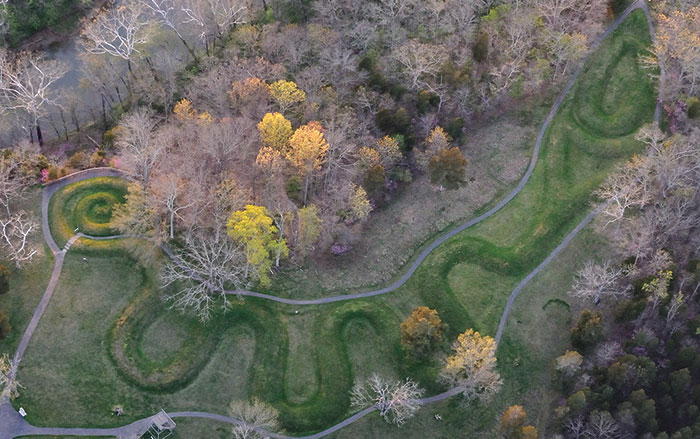
MADISON, WISCONSIN—Sediment cores from Horseshoe Lake, located in the Mississippi floodplain near the center of Cahokia, and Grassy Lake, roughly 120 miles downstream, provide clues to the rise and fall of the ancient city, according to geographers Samuel Munoz and Jack Williams of the University of Wisconsin, Madison. Radiocarbon dating of plant remains and charcoal within the sediment cores helped to create a timeline that includes evidence of frequent floods in the Mississippi River valley between A.D. 300 and 600. Archaeological evidence shows that people moved into the floodplain and began to farm during the arid period after A.D. 600, when Cahokia rose to prominence. But after a major flood event in A.D. 1200, the city began to decline. “We are not arguing against the role of drought in Cahokia’s decline but this presents another piece of information,” Munoz said in a press release. Major flooding after A.D. 1200 could have inundated crops and created agricultural shortfalls. “We see some important changes in the archaeology of the site at this time, including a wooden wall that is built around the central precinct of Cahokia. There are shifts in craft production, house size and shape, and other signals in material production that indicate political, social, and economic changes that may be associated with social unrest,” explained research team member Sissel Schroeder.