
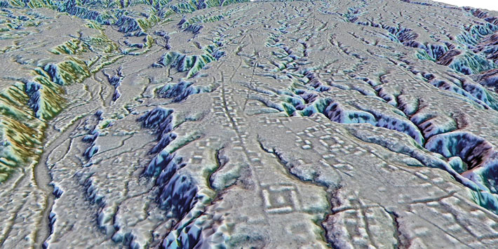
BOHUNICE, SLOVAKIA—The Slovak Spectator reports that a settlement dating back some 7,000 years has been mapped with lidar technology at Hrádok, a hill in central Slovakia, by researchers from the Slovak University of Technology. The team identified stone buildings, terraces, fields, and vineyards, in addition to a fortress and stone wall. “You can see numerous terraces, as well as remnants of stone heaps—piles of stones marking ancient vineyard boundaries—and traces of vanished cellars and dwellings,” said team member Tibor Lieskovský. The fortress was constructed after the medieval invasion of the Tartars to protect trade routes to nearby mining towns. The site later became part of a network of forts that offered protection from the Ottomans. To read more about the archaeology of Slovakia, go to "Neolithic Mass Grave Mystery."
Hillside Fortress in Slovakia Mapped With Lidar
News February 14, 2025
Recommended Articles
Digs & Discoveries May/June 2024
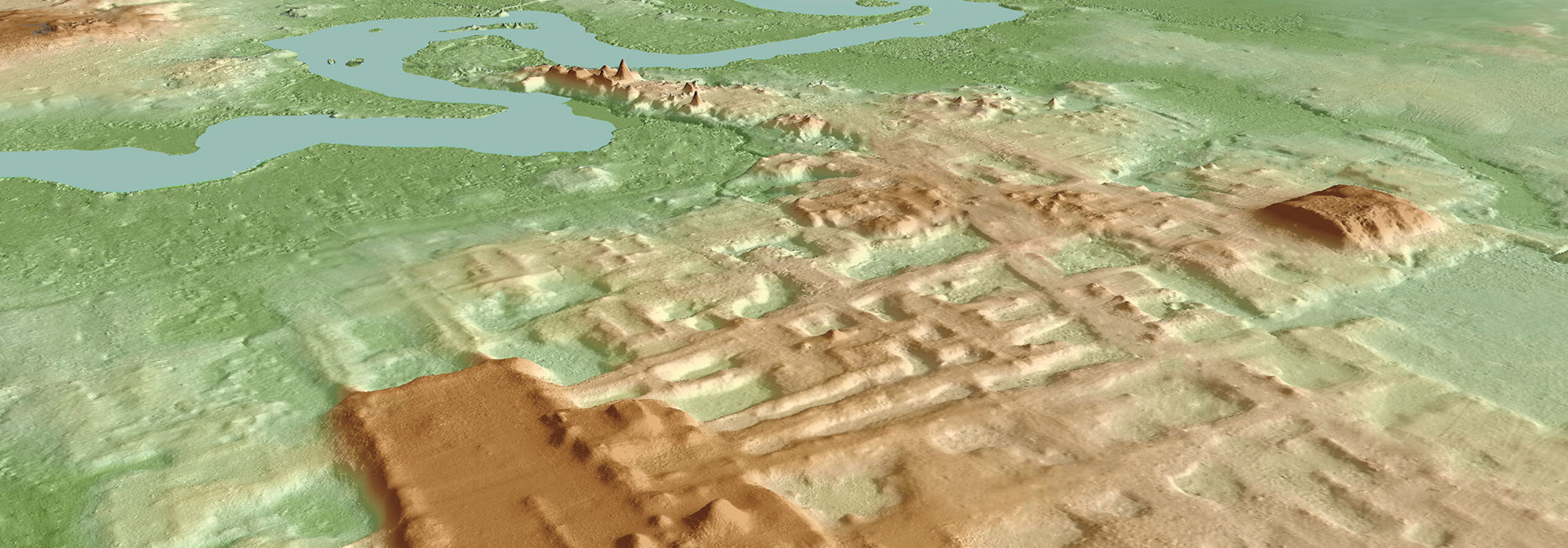
The Amazon’s Urban Roots
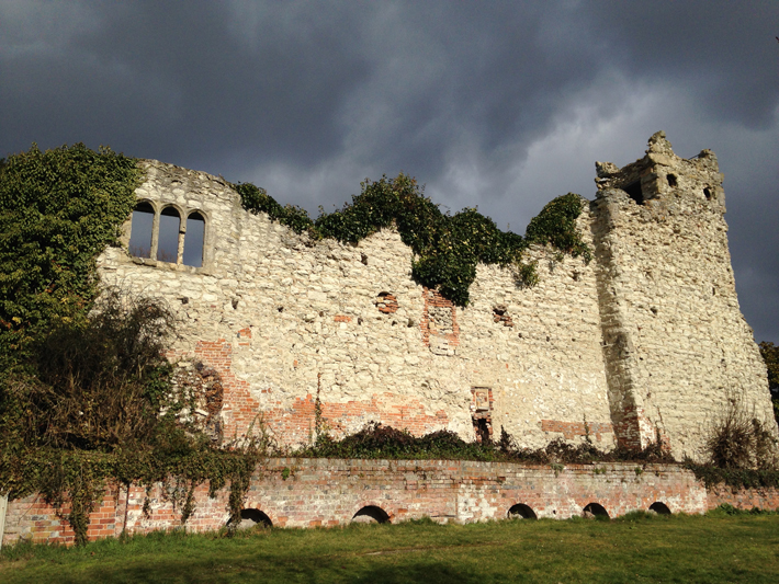
Letter from England July/August 2018
Inside the Anarchy
Archaeologists explore the landscape of England’s first civil war
More to Discover
Features January/February 2025
Top 10 Discoveries of 2024
ARCHAEOLOGY magazine reveals the year’s most exciting finds
-
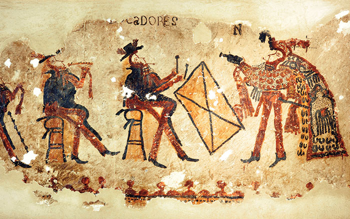
Features January/February 2025
Dancing Days of the Maya
In the mountains of Guatemala, murals depict elaborate performances combining Catholic and Indigenous traditions
 Photograph by R. Słaboński
 -
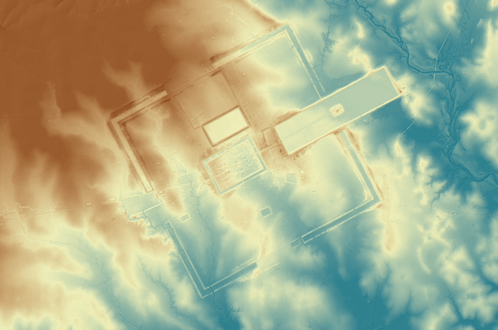
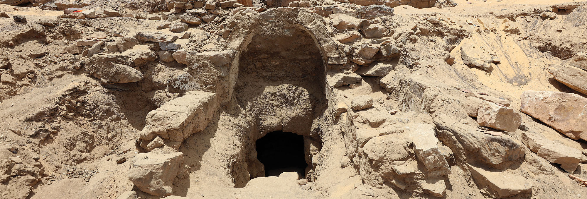
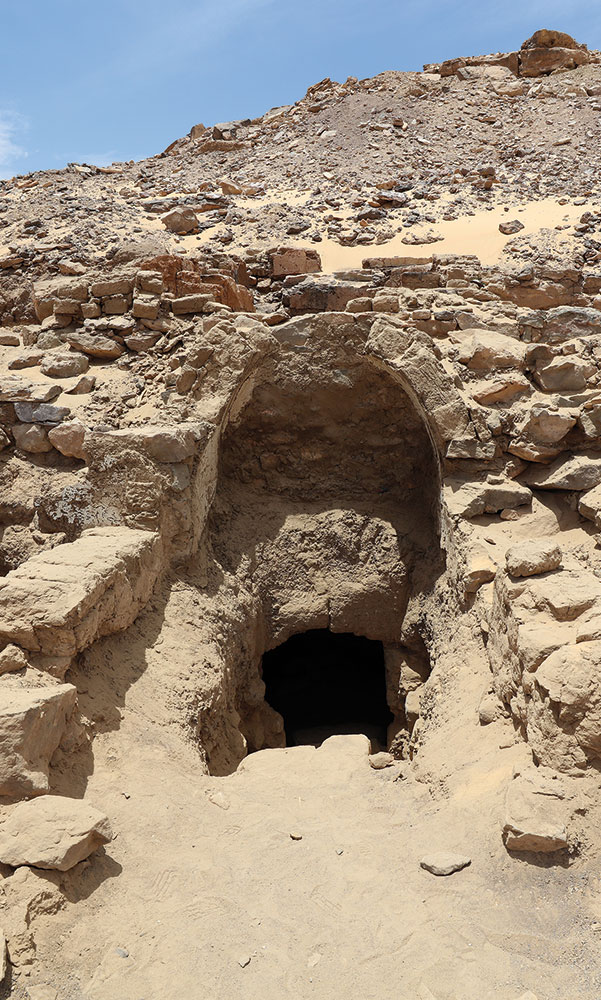
Features January/February 2025
Unearthing a Forgotten Roman Town
A stretch of Italian farmland concealed one of the small cities that powered the empire
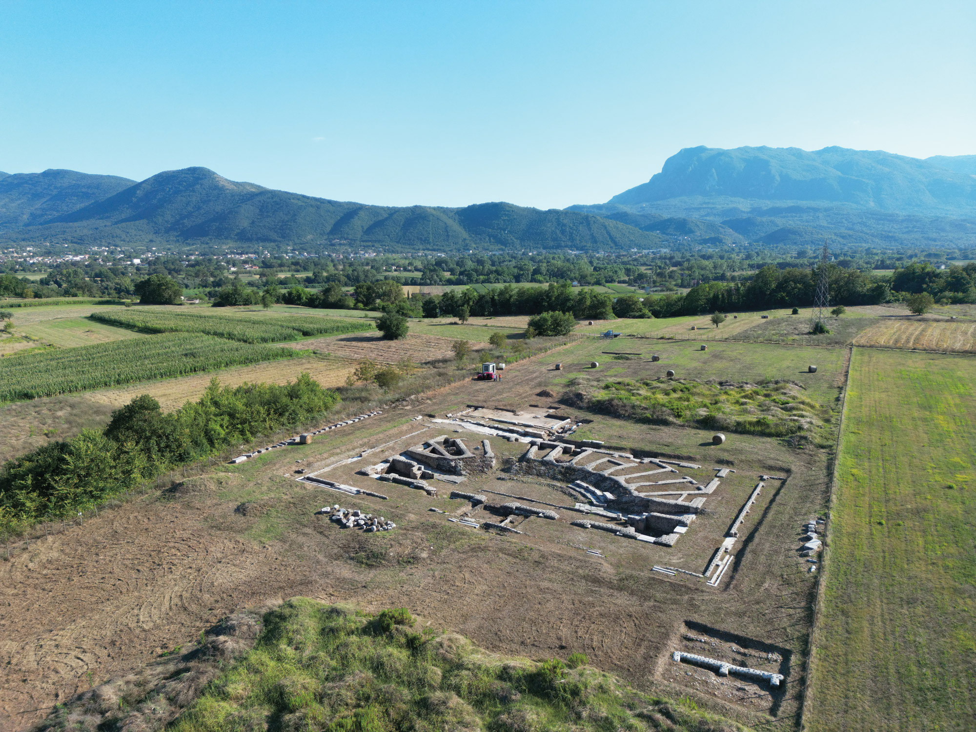 Photo Courtesy Alessandro Launaro
 -
Features January/February 2025
Medieval England’s Coveted Cargo
Archaeologists dive on a ship laden with marble bound for the kingdom’s grandest cathedrals
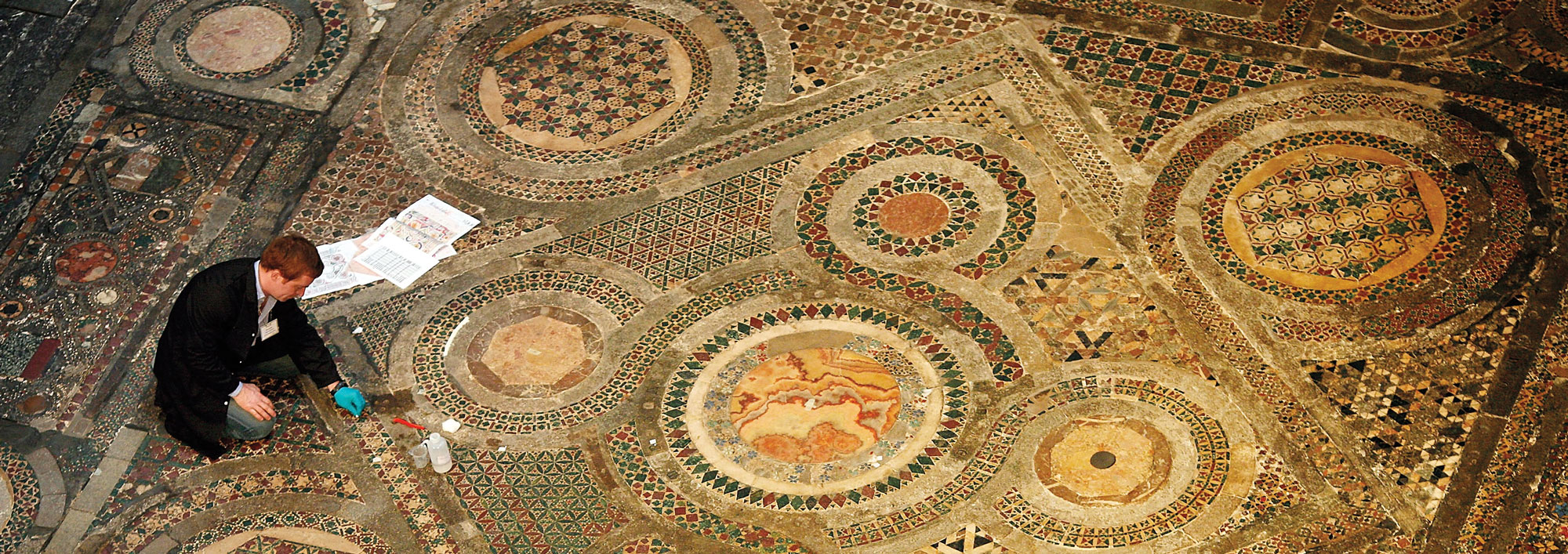 Peter Macdiarmid/Getty Images
 -
Features January/February 2025
Lost Greek Tragedies Revived
How a scholar discovered passages from a great Athenian playwright on a discarded papyrus
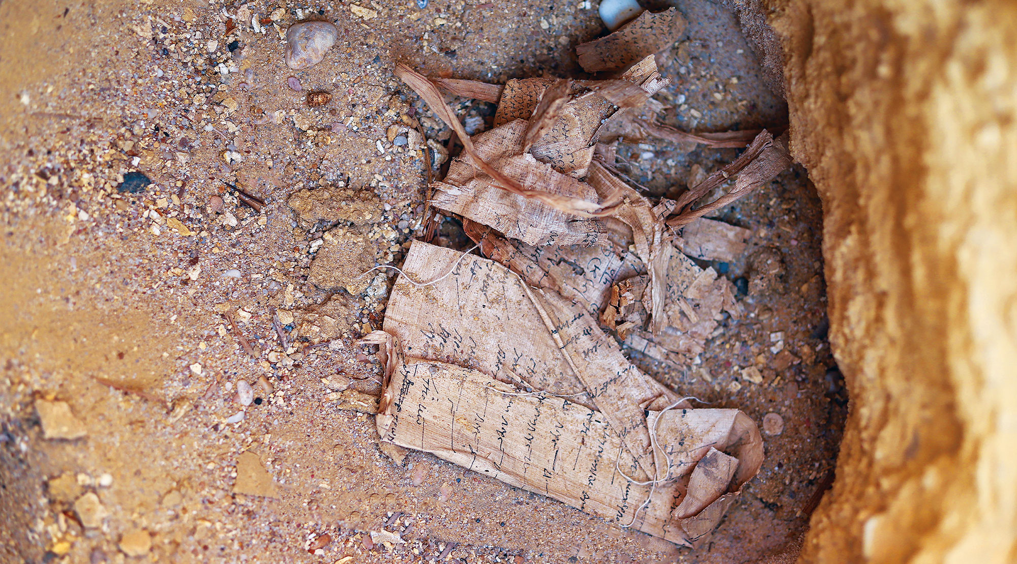 Egyptian Ministry of Tourism and Antiquities