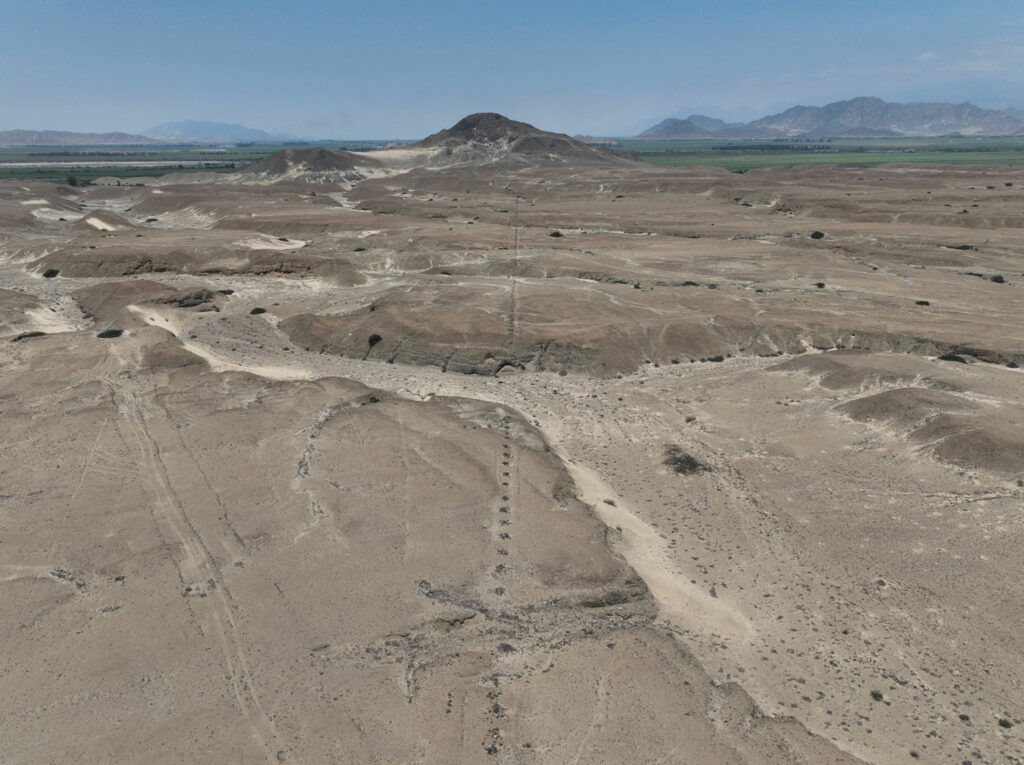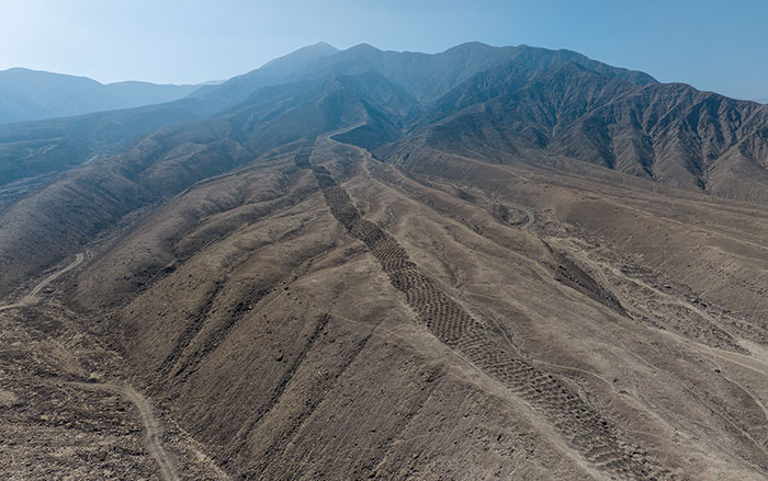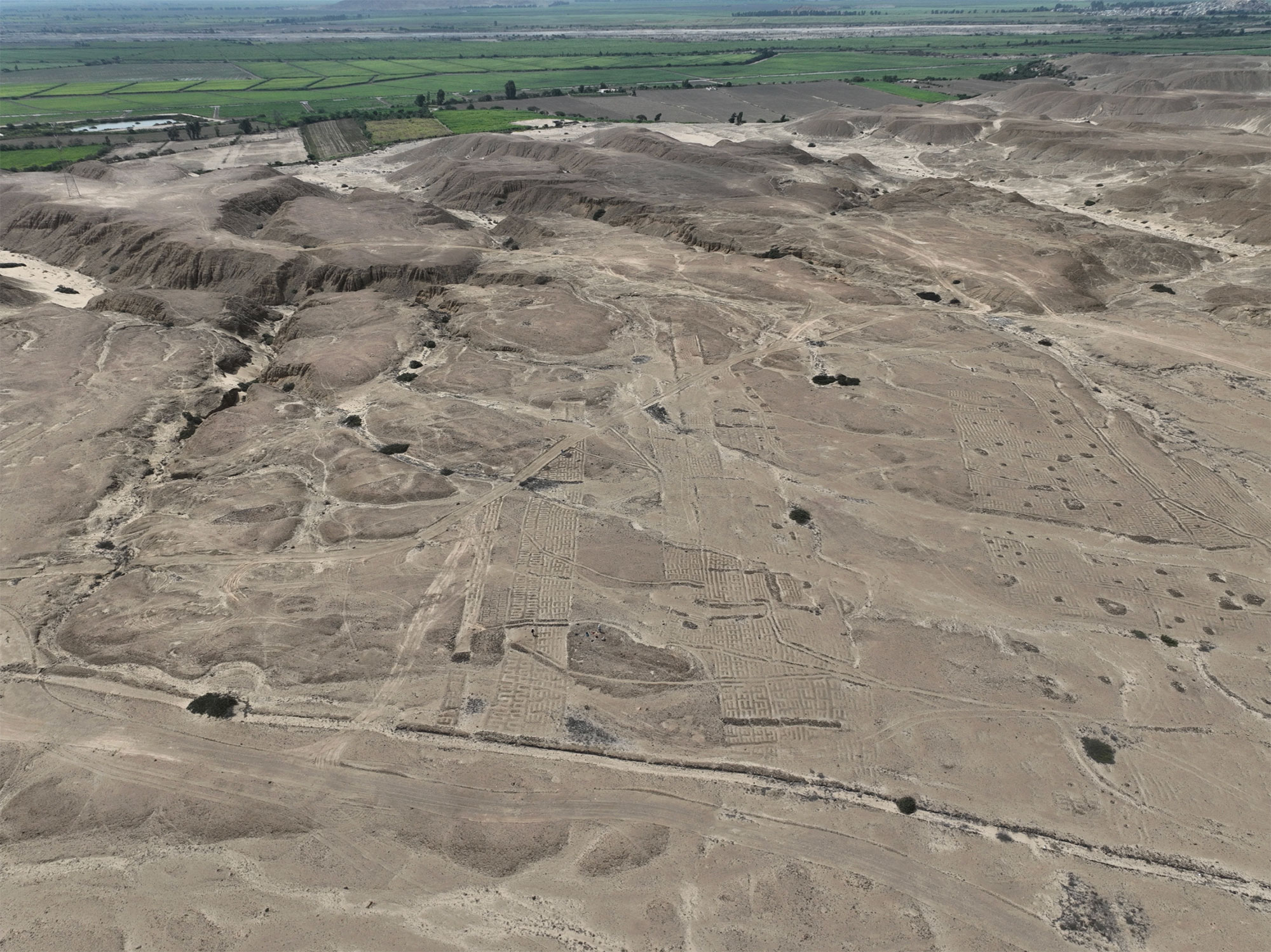
TRUJILLO, PERU—A sacred road stretching for more than a mile has been mapped in northern Peru’s Chicama Valley with drones, Andina reports. The straight stone line, which cuts across ravines and open terrain, is thought to have been used by the Chimú people as a ceremonial route linking a fortified settlement, agricultural fields, and a ceremonial complex, said archaeologist Henry Tantaleán of the Chicama Archaeological Program. The aerial imagery has allowed researchers to map the geoglyph in its entirety. The team also noted that agricultural fields along the route had serpentine furrows and were watered with secondary canals that branched from the Gran Canal de la Cumbre. Soil samples from the agricultural fields are being tested for phytoliths and pollen, which would show what crops were cultivated. A stone platform and a rectangular plaza were also found along the sacred road. Tantaleán thinks this open space may have been used for large ritual gatherings linked to agricultural cycles and the organization of agricultural work. To read about the origins of a mile-long pattern in Peru's coastal desert, go to "Return to Serpent Mountain."