
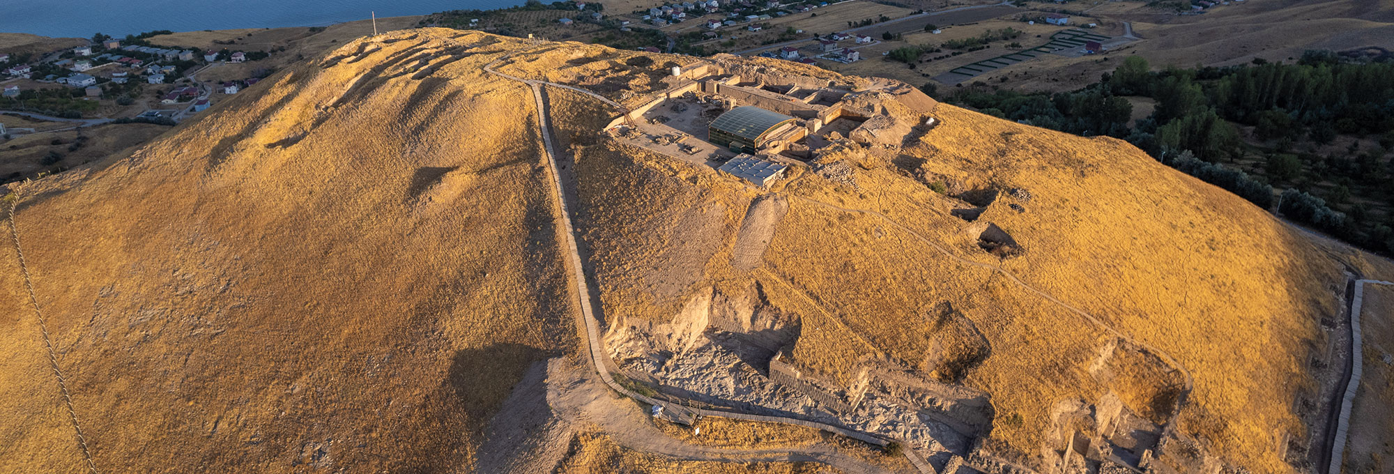
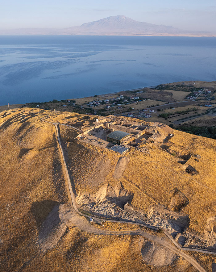
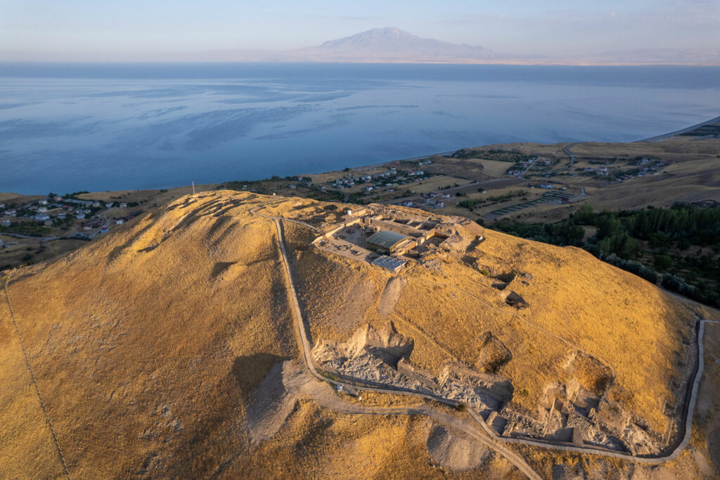
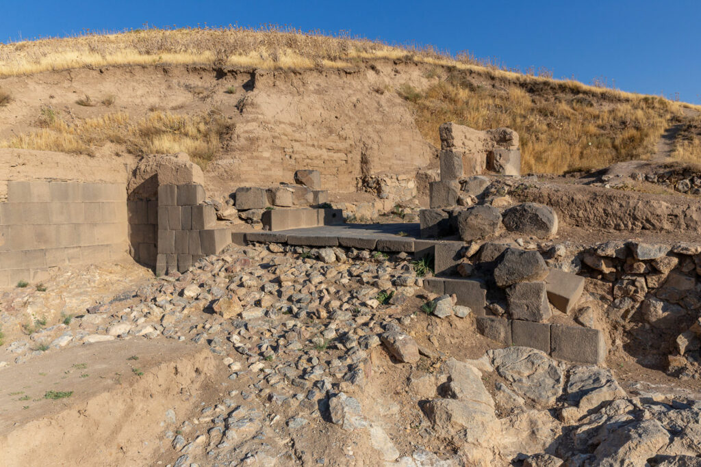
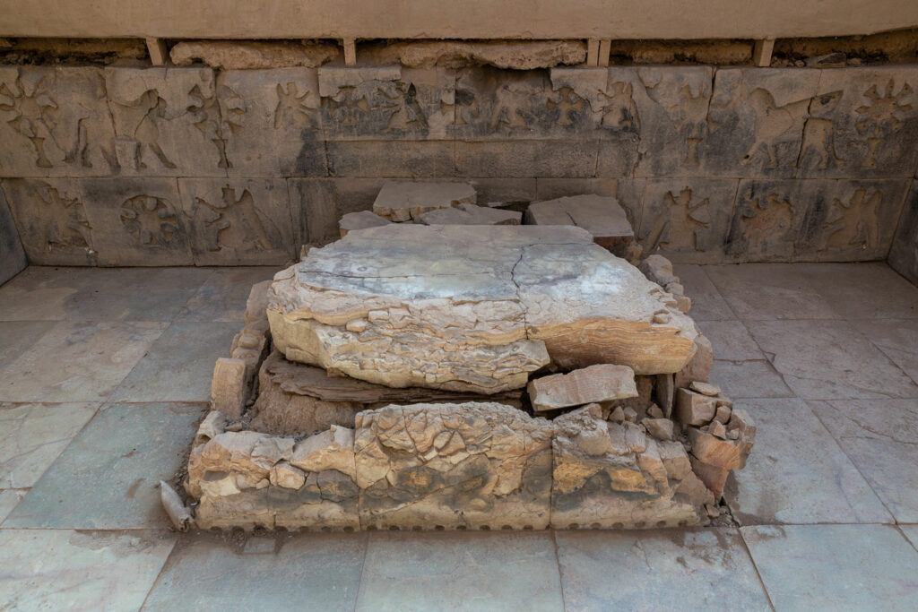
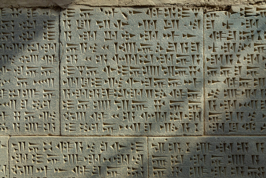
Entering the citadel of Ayanis in eastern Turkey, which is perched more than a mile above sea level, visitors reach a monumental gate and watchtowers made of carefully smoothed light gray andesite blocks. To the south, dark gray basalt blocks make up the citadel’s imposing walls. Atop the stonework, pale brown mudbrick walls ranging from 13 to 20 feet thick still stand after two and a half millennia, reaching as high as 56 feet. Farther up, a wooden stairway climbs the eastern slope and offers sweeping views of the waters of Lake Van, with the silhouette of Mount Süphan looming behind. With every step up the slope, the wind sweeping across the ridge blows stronger. At the summit, trenches from past archaeological campaigns are visible along with newly opened excavation areas, which encompass a large temple complex dedicated to the warrior god Haldi. In the eastern wing of the complex, at the center of a large hall whose walls are adorned with images of winged lions, sphinxes, demons, the tree of life, and rosettes, stands a finely carved stone platform decorated with similar motifs. The platform boasts a 52-foot-long, 88-line inscription recording the achievements of Rusa II, the seventh-century b.c. Urartian king who commissioned it. One section of the inscription reads:
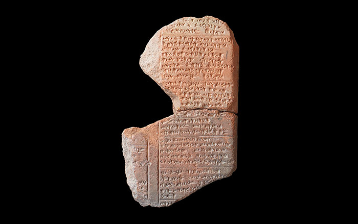
For the god Haldi, his Lord, Rusa, son of Argishti, built this temple and he created and dedicated a gate of the god Haldi to perfection in the city “Rusahinili in front of Mount Eiduru” for the god Haldi. Rusa says: The rock was bare and the earth was deserted; nothing had ever been built there. When the god Haldi gave me kingship, I sat down on the fatherly throne of kingship. Then I built this gate of the god Haldi to perfection. On behalf of the god Haldi, on behalf of the gate of the god Haldi, may there be life, joy, greatness, and strength of a lion, favor and protection for Rusa, son of Argishti, for the regions and for the Bia lands.
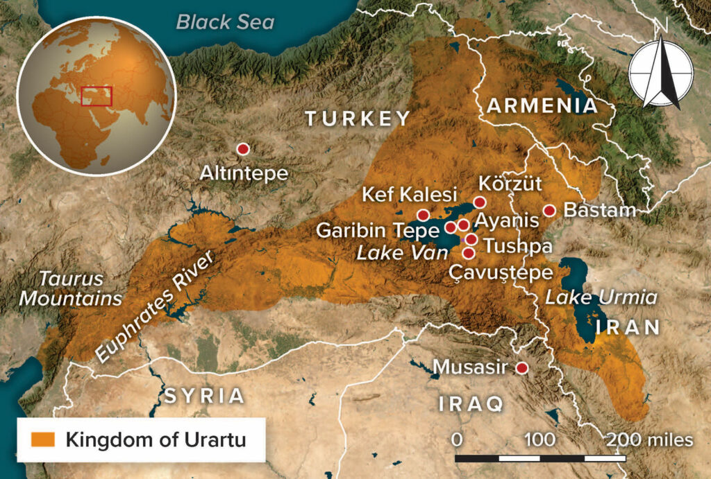
Discovered in 1977, this is the longest and best-preserved temple inscription to have been found in the Kingdom of Urartu. From the ninth to seventh century b.c., the Urartians controlled the mountainous region from the Upper Euphrates Basin to the Caspian Sea. In this land of high plateaus, deep valleys, and inland lakes, the Urartians created a vast network of citadels that connected the most rugged corners of their world, which included what are now parts of eastern Turkey, Armenia, Azerbaijan, and northwestern Iran. “What makes Urartu exceptional is that it was the first state in eastern Anatolia to emerge from the region itself,” says archaeologist Erkan Konyar of Istanbul University. “Urartu was governed from the capital of Tushpa [modern Van] by a local dynasty that built a durable political system in its own homeland.”
The Urartians introduced written administration, planned urban life, and the idea of the state to eastern Anatolia and the Southern Caucasus. They were master engineers who built extensive hydraulic infrastructure, practiced artists who created delicate paintings and intricate ivory carvings, and skilled metalworkers who fashioned bronze sculptures as well as weapons of the highest quality. They were also fierce warriors and accomplished equestrians who, in nearly equal measure, defended themselves against and attacked the Iron Age Near East’s most formidable rulers, the kings of the Neo-Assyrian Empire (ca. 883–609 b.c.). Assyrian and Urartian royal inscriptions, which document the conflicts, campaigns, and territorial conquests between the two powers, as well as Urartian inscriptions that record campaigns against other local kingdoms and chiefdoms, provide evidence that Urartu was a major military power in the region.
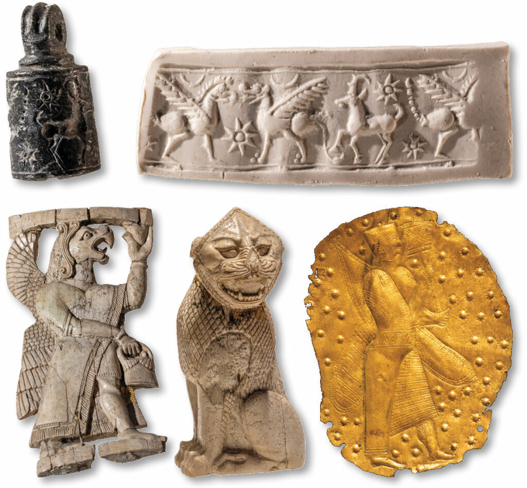
Although they were the Assyrians’ perennial foes, the Urartians borrowed from them, too, especially at the start of their rule. “Early inscriptions suggest that Assyrian was initially the administrative language of Urartu,” says Urartologist Kenan Işık. It was the Assyrians who named the kingdom Urartu, a moniker that began to appear in inscriptions dating to the reign of the thirteenth-century b.c. Assyrian king Shalmaneser I. The Urartians called their kingdom Biainili, or “the land of Bia,” but scholars are uncertain of the origin or meaning of Bia. Over time, Neo-Assyrian cuneiform script was adapted to express the Urartian language, which is not related to the Semitic or Indo-European languages that were used in the rest of the ancient Near East. Early Urartian royal inscriptions frequently borrowed Assyrian titles and formulaic expressions. Urartian kings also embraced the Assyrian practice of commemorating building projects and military campaigns with monumental carved reliefs, tailoring this custom to their own style and cultural traditions over time. Furthermore, some Urartian decorative motifs, such as the tree of life and the prevalence of fantastical winged lion imagery, were clearly inspired by Assyrian artisans.
The Urartians are, of course, far less well known than their nemeses. “The Assyrians are in some ways quite familiar because they are in the Bible, they controlled so much territory, and they documented so many of their empire’s deeds and inner workings,” says archaeologist Emily Hammer of the University of Pennsylvania. “The story about the Urartians for a long time had been that they were derivative of the Assyrians because they write in Assyrian script, their art is inspired by Assyrian art, and so on. But the Assyrians were obsessed with the Urartians—they wrote about them constantly and they waged yearly campaigns against them—so the people who we already care about and know a lot about, the Assyrians, one of the people they cared a lot about were the Urartians.” In addition, Hammer says, it’s becoming increasingly apparent that the Urartians were inspired not just by Assyrian culture and technology, but also by a diverse range of eastern Anatolian cultures.
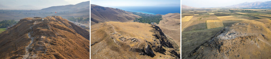
Since the discovery of Urartian tombs and artifacts at the site of Altıntepe in 1938, archaeologists have excavated between 40 and 50 Urartian sites, though these represent only a small fraction of the kingdom’s archaeological landscape. Hundreds more sites, including fortresses, settlements, necropolises, and reservoirs, are known to exist.Excavations of sites such as the Anatolian fortresses of Ayanis, Çavuştepe, Kef Kalesi, and Körzüt, Bastam in Iran, and Metsamor, Argistihinili, Erebuni, and Karmir Blur in Armenia, as well as monuments found in and near Tushpa, including the tomb of the king Argishti II, have shaped scholars’ understanding of the kingdom. Yet much remains unknown. “The biggest question concerning the Urartian state is how the relationship between the monarchy and local tribes was managed, because it wasn’t possible to rule the entire vast kingdom, divided by mountain ranges, directly from Tushpa,” says Konyar. “But we don’t know the extent to which the relationship between the king and local tribal leaders, who paid taxes, provided soldiers, and maintained public order, relied on military coercion, mutual interests, or political negotiation.”
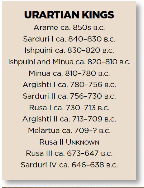
Urartu’s story begins in the ninth century b.c., when small, scattered chiefdoms surrounding Lake Van united under the rule of a one king. Assyrian records from this point on speak not of many rulers, but of a single king of Urartu. It appears that the chiefdoms of Uruadri, Nairi, and other neighboring regions in the Van Basin joined forces at this time to form a united front against the Assyrians. “We know from their texts, which are far more limited than those of the Assyrians, that the Urartians conquered some named peoples and territories,” says Hammer. “They clearly had a large military force and were militarily inclined because they were fighting the Assyrians all the time.”
The first king of the new alliance was Arame. He was followed by Sarduri I, who commissioned six parallel inscriptions on large travertine blocks at the western end of the citadel of Tushpa, over which Ottoman structures were later built. This text, the earliest written record known from Urartu, proclaims the young kingdom’s ideology and legitimacy:
Sarduri, son of Lutipri, is the great king, the mighty king, king of all, king of the land of Nairi, a king without equal, a marvelous shepherd, fearless in battle, who subdues the rebellious. I, Sarduri, son of Lutipri, king of kings, have received tribute from all kings. Sarduri, son of Lutipri, says: I brought the limestone blocks of this structure from the city of Alniunu. I built this wall.
Sarduri I was succeeded by his son Ishpuini, who expanded Urartu’s borders. Ishpuini co-ruled with his son Minua for a time. Once Minua assumed sole rule, he accelerated the kingdom’s expansion and transformed his realm.“Minua can be regarded as the true architect of the Urartian urban system,” says historian Can Avcı of Istanbul University. “What are commonly called fortresses were in fact carefully planned cities. For the first time, administrative, religious, residential, and funerary spaces were integrated into a coherent urban plan.” At sites across Urartu, Minua founded new royal centers and revamped old strongholds. Palaces, temples, and storage buildings were constructed in the higher areas of these settlements, forming administrative centers enclosed by fortification walls. Archaeological evidence shows that people lived in lower parts of these settlements.
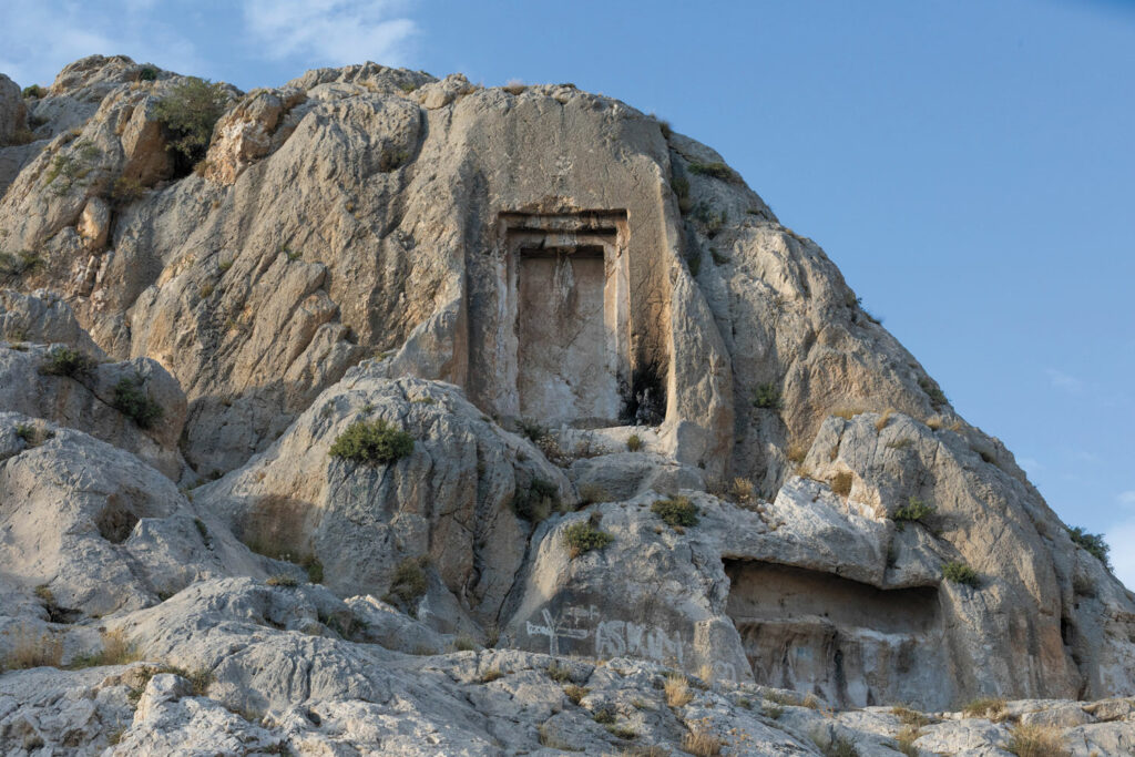
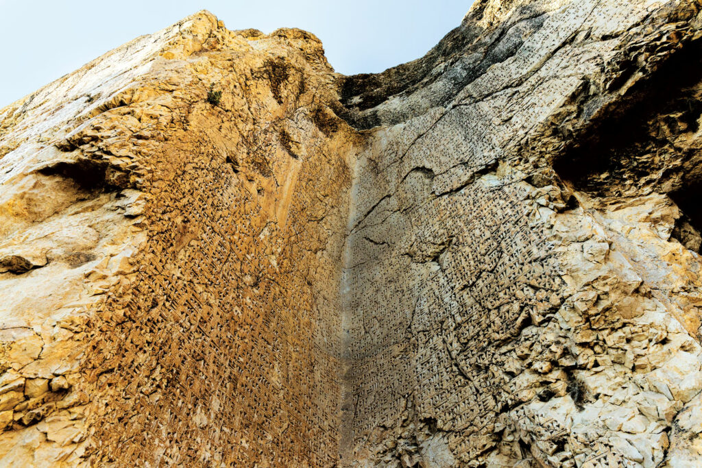
The ruling class settled in fertile plains, and a network of fortresses and small garrisons provided oversight of the empire in rural areas. “Most communities across the Urartian landscape lived outside monumental centers in multiethnic groups and followed a largely nomadic way of life,” Konyar says. “The fortresses were built to project central authority and deterrence with relatively small numbers of soldiers.” The state also made its presence known across the rural landscape on mountain passes and along highland routes, where Urartian kings commissioned door-shaped monuments carved into the bedrock and rock inscriptions—more than 300 of which are known—to remind people of their authority. The texts are short and repetitive: three lines in Assyrian and three lines in Urartian mentioning little more than the name of the god Haldi, the king’s titles, and a few place-names. “The purpose of these inscriptions was not so much to be read as to be seen,” says archaeologist Kemalettin Köroğlu of Marmara University. “The main aim was to deliver a clear message to nomadic or seminomadic communities that a state exists in this landscape and it’s the ruling power. These inscriptions function less as narrative texts and more as practical monuments marking the state’s boundaries and authority.”
Undergirding the Urartian state was a pantheon headed by Haldi, whose cult was centered just outside the kingdom’s bounds at the sacred city of Musasir in what is now northern Iraq. As chief priest, the Urartian king embodied both political power and religious leadership and brought diverse beliefs together under the chief divinity. During the reigns of Ishpuini and Minua, the entire state pantheon was recorded for the first time on a door-shaped rock monument known as the Meher Gate. Located in Tushpa, this inscription lists 79 gods and goddesses, beginning with Haldi and followed by the weather god, Teisheba, and the sun god, Shivini. The inscription also enumerates the types and numbers of animals to be sacrificed to each deity. The Urartians believed that the gods emerged from the rocks into the world of humans, and such rock-cut gates were considered sacred passages. “The Meher Gate is not merely a rock monument,” Işık says. “It’s one of those thresholds where belief and myth intertwine.”
EXPAND
The Artists of Urartu
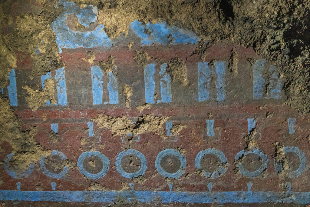
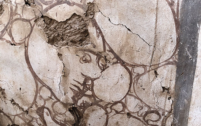
Some of the best-preserved examples of Urartian mural art were exposed by looters in 2022 at the site of Garibin Tepe, located about two miles from the Urartian citadel of Ayanis in eastern Turkey. After the looters were apprehended, a team led by archaeologist Mehmet Işıklı of Atatürk University conducted the first archaeological investigation of the site. Conservation and restoration work began at the same time. At Garibin Tepe, recurring images of shields, rosettes, and bulls, as well as scenes of people holding buckets, libation vessels, and ritual containers run along the walls of a room that Işıklı thinks belongs to an architectural complex. “These images, as always in Urartian art, appear as visual expressions of royal and religious ideology through repeated depictions of ritual participants, sacred animals, and protective beings associated with the divine order,” says Işıklı. “We know from inscriptions that Urartian religion had a priestly class, but whether these figures represent priests, deities, or other sacred beings is uncertain, as Urartian art rarely identifies figures with accompanying inscriptions.”
Some of the murals’ motifs, such as rosettes, a possible lion, and standing human figures carrying objects interpreted as ritual implements or containers, and a lower register of floral or possibly symbolic shield-like images, have strong parallels with the broader visual traditions of the ancient Near East, including Assyria. These motifs’ precise meaning is still being studied. “The wall paintings weren’t random decorations, but part of a carefully planned visual narrative,” says conservator Özlem Toprak Cihan of the Istanbul Restoration and Conservation Center Regional Laboratory, who has worked on the murals since 2022. “We hope the meaning will become clearer as archaeological excavations reveal more of the complex.”—T.İ.
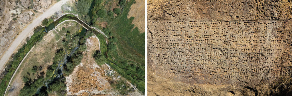
The Urartians’ skill as builders was not limited to state and religious architecture. For a kingdom to thrive, it needs water for its people to drink and to irrigate their fields, a challenge that was especially pressing in a region where the altitude makes growing seasons much shorter. In addition, the water in Urartu’s highly saline lakes is not suitable for irrigation. The Urartian kings rose to the challenge. One of the most effective of their solutions was a canal built by Minua east of Tushpa in the early eighth century b.c. “The canal was constructed to meet Tushpa’s growing water needs,” says archaeologist Sabahattin Erdoğan of Van Yüzüncü Yıl University. “It’s one of the Urartians’ earliest systematic engineering achievements, in which they mastered both geography and stone to bring water efficiently from distant sources.” The canal, sections of which are still used today, traveled approximately 30 miles from springs in the Gürpınar Plain south of Lake Van toTushpa. Along its course, 14 inscriptions commissioned by Minua boast of his achievement. One reads:
Minua, son of Ishpuini, opened this canal by the power of the god Haldi. Its name is the Minua Canal. By the greatness of the god Haldi, Minua is the mighty king, the great king, king of the land of Biainili, king of the city of Tushpa, ruler of the city of Tushpa. Minua says: Whoever destroys this inscription, whoever commits an offense, whoever orders another to do so, whoever says something different and claims “I dug this canal,” may the god Haldi, the god Teisheba, the god Shivini, and all the gods wipe him from under the sun.
Minua’s grand initiative represents the beginning of a system of planned water management in Urartu. “The Minua Canal was not merely an engineering success, it became a model for later kings,” Işik says. The canal also provides evidence that the Urartians were not simply imitators of Assyrian culture, but innovators. “The Minua Canal is actually earlier than the big hydraulic projects in the Assyrian heartland,” Hammer says. “This doesn’t fit into the narrative that the Urartians were just derivative.”
At Çavuştepe, a strategically located fortress overlooking the main pass through the Bolkar Mountains, which was founded by Sarduri II, the Urartians devised yet another solution to meet their need for water. There, the king built three enormous cisterns that could each hold 26,000 gallons of water. In the 1960s, archaeologists learned that Urartian engineers had carved one cistern directly into the bedrock and sealed natural fissures in the rock with an approximately 30-inch-thick layer of clay. They then covered the clay with a layer of stone, creating a remarkably effective waterproof system that kept the water at about 55 degrees Fahrenheit, even in the heat of summer.
The Urartian kings were able to hold back the Assyrians to a greater or lesser extent for two centuries. Some Urartian kings even claimed to have bested their rivals on the battlefield multiple times. Minua, Argishti I, and Sarduri II all boasted in monumental inscriptions of military campaigns they organized against Assyria and the victories they achieved.But in the second half of the eighth century b.c., the Assyrian king Tiglath-Pileser III defeated Sarduri II and advanced as far as the gates of Tushpa. In 714 b.c., Tiglath-Pileser’s son Sargon II attacked the holy site of Musasir. Sargon’s record of the assault reads:
I let the terrifying cry of my troops resound against that site like the thunder of the storm god....Their ruler had not respected the command of the god Ashur but had thrown off the yoke of my overlordship and despised his position as vassal to me. I planned to take the people of that city into captivity, and I ordered the removal of the god Haldi.
Although Sargon did not attack Tushpa, the Urartians were crippled after the sack of Musasir. The kingdom was also beaten down by waves of destruction wrought by mounted nomadic groups such as the Cimmerians from the Pontic-Caspian Steppe, the Scythians, a people of Iranian origin who controlled the Eurasian Steppe for the better part of the first millennium b.c., and the Medes, who founded a sprawling empire in western and northern Iran. In a mountainous landscape such as that of Urartu, these pressures may have weakened the already relatively loose control exercised by the central government. The onslaught of these warrior groups appears to have coincided with increasing tensions among the many tribal and princely communities that formed the kingdom. The local Urartian economy had been based on mining, animal husbandry, and grain cultivation at a level sufficient to satisfy communities’ needs, whereas the state appears to have prospered largely through a war economy and by conducting systematic raiding campaigns against neighboring regions. Through warfare and tribute, Urartian rulers acquired slaves, livestock, and mineral resources, thereby sustaining both their wealth and political power.
For more than 50 years, archaeologist Stephan Kroll of Ludwig Maximilian University of Munich has led a team excavating the citadel of Bastam in northwestern Iran, which was built by Rusa II and exemplifies both the success and demise of Urartu. The team has unearthed approximately 1,500 clay bulla, or seal, impressions of the king and high-ranking officials at the site, indicating that storage and distribution of grain and other resources at Bastam were carried out under strict central control. “Bastam was not merely a military or architectural center,” Kroll says, “but evidence that Urartu possessed a highly organized economic and administrative structure.” Bastam appears to have remained so even in the decades leading up to its collapse. “This was a time of prosperity,” says Kroll. “Storerooms were filled with grain, wine, and oil.”
The kingdom’s prosperity did not last. At Bastam, the team has unearthed more than 1,500 animal bones, most likely remnants of meat prepared for the winter, which burned in a fire that accompanied the citadel’s violent destruction in the late seventh century b.c. “The catastrophe that destroyed the fortress appears to have come suddenly,” says Kroll. Archaeologists have identified similar evidence of fire and destroyed buildings at Ayanis as well as at all other late Urartian citadels. “The collapse of Urartu appears to have been connected to the inherently fragile nature of its state organization, in addition to external attacks,” Konyar says. “The construction of royal cities, agricultural production, irrigation, the settlement of populations, and craft production were all regulated largely by the central administration. When this mechanism weakened, the logistical support sustaining the cities was disrupted, and the administrative and cultural system created by the state rapidly disintegrated.”
Following the collapse of Urartu, writing, monumental architecture, the standardized urban model, and traditions of state-controlled production largely disappeared in the kingdom’s former lands, while local ways of life associated with rural and seminomadic communities survived. “Urartu’s end should be understood not simply as a military defeat,” says Konyar, “but as a far-reaching political, economic, and cultural disintegration brought about by the collapse of its centralized state organization.”
A century of scholars have largely characterized Urartu as a kingdom whose identity was defined by its clashes with and emulation of the Assyrians. Archaeologists are reimagining this narrative by exploring sites across Urartu and reenvisioning the kingdom as a complex and interconnected system based not only on cultural appropriation and military might but on highly organized, deliberate messaging propagated through writing, art, architecture, and infrastructure. “Urartu mattered not simply because it fought Assyria,” says Kroll, “but because it transformed the highlands of eastern Anatolia and beyond into one of the ancient Near East’s most organized political landscapes.”
Video: The Last Urartian Speaker
Since 1962, Mehmet Kuşman has worked as a caretaker at the site of the fortress at Çavuştepe in eastern Turkey’s Van Province. Çavuştepe is one of perhaps dozens of such fortresses in a vast network constructed during the Iron Age by the rulers of the Kingdom of Urartu, who controlled parts of eastern Turkey, Armenia, Azerbaijan, and Iran from the ninth to the seventh century b.c. For decades, even long after his official retirement, Kuşman has studied, written, read, and spoken the Urartian language. In this video, listen as he reads some of the most famous Urartian inscriptions found at Çavuştepe and carves his own sayings and phrases in Urartian, which is more than 2,500 years old and remains barely known, even today. Get your copy of the November/December 2026 issue of ARCHAEOLOGY on newsstands, and subscribe to explore more.
Further Reading
The Assyrian Renaissance
Archaeologists return to Nineveh in northern Iraq, one of the ancient world’s grandest imperial capitals
Assyrian Women of Letters
4,000-year-old cuneiform tablets illuminate the personal lives of Mesopotamian businesswomen
When Lions Were King: Mesopotamia
The Assyrian inspiration behind the art of Urartu
The Price of Plunder
Exploring Iron Age Iran’s most famous—and most looted—site